Hillsdale, Kansas facts for kids
Quick facts for kids
Hillsdale, Kansas
|
|
|---|---|

|
|
| Country | United States |
| State | Kansas |
| County | Miami |
| Elevation | 892 ft (272 m) |
| Time zone | UTC-6 (CST) |
| • Summer (DST) | UTC-5 (CDT) |
| ZIP code |
66036
|
| Area code | 913 |
| FIPS code | 20-32300 |
| GNIS ID | 0479414 |
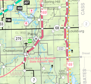
Hillsdale is an unincorporated community in Miami County, Kansas, United States. Hillsdale is located near U.S. Route 169 and K-7 6 miles (9.7 km) north-northeast of Paola. It is part of the Kansas City metropolitan area.
Contents
History
Hillsdale, originally called Columbia, was laid out in 1869 when the railroad was extended to that point.
The first post office in Columbia, established in August 1868, was renamed Hillsdale in April 1870, and still has a post office with ZIP code 66036.
Demographics
For statistical purposes, the United States Census Bureau has defined Hillsdale as a census-designated place (CDP).
Education
The community is served by Paola USD 368 public school district.
See also
 In Spanish: Hillsdale (Kansas) para niños

All content from Kiddle encyclopedia articles (including the article images and facts) can be freely used under Attribution-ShareAlike license, unless stated otherwise. Cite this article:
Hillsdale, Kansas Facts for Kids. Kiddle Encyclopedia.

