Hodikof Island facts for kids
 |
|
| Geography | |
|---|---|
| Coordinates | 52°52′20″N 173°17′40″E / 52.87222°N 173.29444°E |
| Archipelago | Near Islands group of the Aleutian Islands |
| Length | .1 mi (0.2 km) |
| Width | .1 mi (0.2 km) |
| Administration | |
|
United States
|
|
| State | Alaska |
| Census Area | Aleutians West Census Area |
| Demographics | |
| Population | 0 (2010) |
| Pop. density | 0 /km2 (0 /sq mi) |
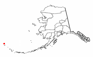
Hodikof Island (52°52'N 173°18'E) is a tiny 0.1-mi-long satellite of Attu Island in the Near Islands at the extreme western end of the Aleutian Islands, Alaska. Its name is derived from Hodikof Point, and it lies in Sarana Bay on the east side of Attu. The seaward extension of Hodikof Island is known as Hodikof Reef.
See also
 In Spanish: Isla Hodikof para niños

All content from Kiddle encyclopedia articles (including the article images and facts) can be freely used under Attribution-ShareAlike license, unless stated otherwise. Cite this article:
Hodikof Island Facts for Kids. Kiddle Encyclopedia.
