
Horsley, New South Wales facts for kids
Quick facts for kids HorsleyWollongong, New South Wales |
|||||||||||||||
|---|---|---|---|---|---|---|---|---|---|---|---|---|---|---|---|
 |
|||||||||||||||

Horsley
Location in New South Wales
|
|||||||||||||||
| Population | 8,221 (2016 census) | ||||||||||||||
| Postcode(s) | 2530 | ||||||||||||||
| LGA(s) | City of Wollongong | ||||||||||||||
| State electorate(s) | Shellharbour | ||||||||||||||
| Federal Division(s) | Whitlam | ||||||||||||||
|
|||||||||||||||
Horsley is a suburb in Wollongong. It is the location of the new Dapto Primary school and a community centre. This suburb has expanded since 1999 and contains many newly developed houses.
Dapto Public School
The school used to be located on Byamee Street in the neighbouring urban suburb of Dapto. The school site is now on Sierra Drive, Horsely in a predominately residential area.
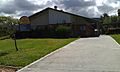
-
The school entrance
-
The administration office


World War II aircraft crash
On 4 November 1942, a Royal Australian Air Force Lockheed Hudson crashed on Bong Bong Mountain, just west of Horsley, killing all four crew members.
Demographics
As of the 2016 Census Night there were 8,221 persons counted in Horsley, 48.8% were males and 51.2% were females. Of the total population 2.6% were of Indigenous origin. The previous Dapto primary school was moved here in 2004.
