
Hungerford, Texas facts for kids
Quick facts for kids
Hungerford, Texas
|
|
|---|---|

Location of Hungerford, Texas
|
|
| Country | United States |
| State | Texas |
| County | Wharton |
| Area | |
| • Total | 1.8 sq mi (4.7 km2) |
| • Land | 1.8 sq mi (4.7 km2) |
| • Water | 0.0 sq mi (0.0 km2) |
| Elevation | 105 ft (32 m) |
| Population
(2010)
|
|
| • Total | 347 |
| • Density | 193/sq mi (73.8/km2) |
| Time zone | UTC-6 (Central (CST)) |
| • Summer (DST) | UTC-5 (CDT) |
| ZIP code |
77448
|
| Area code(s) | 979 |
| FIPS code | 48-35420 |
| GNIS feature ID | 1338297 |
Hungerford is a census-designated place (CDP) in northeastern Wharton County, Texas, United States. U.S. Route 59, Texas State Highway 60, and Farm to Market Road 1161 intersect in the community. The Kansas City Southern Railway Co. passes through Hungerford. The population was 347 at the 2010 census. It is located on what in the 1820s was part of colonist Alexander Jackson's land grant north of George E. Quinan's home. By the 1870s, the Quinan settlement grew up a short distance away, but its residents moved to the new town when the railroad came through Hungerford.
Contents
Geography
Hungerford is located at 29°23′57″N 96°4′37″W / 29.39917°N 96.07694°W (29.399122, -96.077019).
According to the United States Census Bureau, the CDP has a total area of 1.8 square miles (4.7 km²), all of it land.
Demographics
As of the census of 2000, there were 645 people, 169 households, and 117 families residing in the CDP. The population density was 352.1 people per square mile (136.1/km2). There were 177 housing units at an average density of 96.6/sq mi (37.3/km2). The racial makeup of the CDP was 52.87% White, 31.16% African American, 14.26% from other races, and 1.71% from two or more races. Hispanic or Latino of any race were 22.02% of the population.
There were 169 households, out of which 33.1% had children under the age of 18 living with them, 46.2% were married couples living together, 18.9% had a female householder with no husband present, and 30.2% were non-families. 24.3% of all households were made up of individuals, and 14.8% had someone living alone who was 65 years of age or older. The average household size was 3.04 and the average family size was 3.72.
In the CDP, the population was spread out, with 37.7% under the age of 18, 7.4% from 18 to 24, 26.7% from 25 to 44, 18.0% from 45 to 64, and 10.2% who were 65 years of age or older. The median age was 30 years. For every 100 females, there were 90.3 males. For every 100 females age 18 and over, there were 81.1 males.
The median income for a household in the CDP was $46,544, and the median income for a family was $55,781. Males had a median income of $34,688 versus $18,214 for females. The per capita income for the CDP was $16,191. About 7.3% of families and 15.2% of the population were below the poverty line, including 3.7% of those under age 18 and 19.0% of those age 65 or over.
Images for kids
-
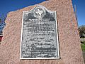
New York, Texas & Mexican Railroad historical marker
-
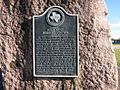
Post West Bernard Station historical marker
-
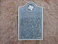
Quinan Community historical marker
-
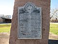
J. D. Hudgins Ranch historical marker
-
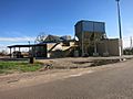
Hungerford Growers Cotton Gin
-
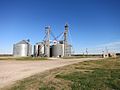
Hungerford Grain Company on FM 1161
-
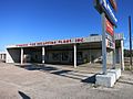
Strouhal Tire Recapping Plant on US 59-Business
-
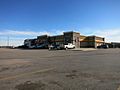
Love's Travel Stop on US 59 and FM 1161


See also
 In Spanish: Hungerford (Texas) para niños
