
Huntingdon, Pennsylvania facts for kids
Quick facts for kids
Huntingdon, Pennsylvania
Standing Stone Village (historical)
|
|
|---|---|
|
Borough
|
|

Presbyterian Church
|
|
| Nickname(s):
Ye Ancient Borough (historical)
|
|
| Motto(s):
"Our Home, Our Town"
|
|

Location of Huntingdon in Huntingdon County, Pennsylvania
|
|

Huntingdon, Pennsylvania
Location in Pennsylvania

Huntingdon, Pennsylvania
Location in the United States
|
|
| Country | United States |
| State | Pennsylvania |
| County | Huntingdon |
| Plat drawn of streets and lots | 1767 |
| Incorporated | 1796 |
| Government | |
| • Type | Borough Council |
| Area | |
| • Total | 3.70 sq mi (9.59 km2) |
| • Land | 3.62 sq mi (9.37 km2) |
| • Water | 0.08 sq mi (0.22 km2) |
| Elevation | 643 ft (196 m) |
| Population
(2020)
|
|
| • Total | 6,827 |
| • Density | 1,887.3/sq mi (728.7/km2) |
| Time zone | UTC-5 (Eastern (EST)) |
| • Summer (DST) | UTC-4 (EDT) |
| ZIP codes |
16652, 16654
|
| Area code(s) | 814 Exchanges: 251,641,643,644 |
| FIPS code | 42-36368 |
Huntingdon is a borough in (and the county seat of) Huntingdon County, Pennsylvania, United States. It is located along the Juniata River, approximately 32 miles (51 km) east of Altoona and 92 miles (148 km) west of Harrisburg. With a population of 7,093 at the 2010 census, it is the largest population center near Raystown Lake, a winding, 28-mile-long (45 km) flood-control reservoir managed by the U. S. Army Corps of Engineers.
The borough is located on the main line of the Norfolk Southern (formerly Pennsylvania) Railway, in an agricultural and outdoor recreational region with extensive forests and scattered deposits of ganister rock, coal, fire clay, and limestone. Historically, the region surrounding Huntingdon was dotted with iron furnaces and forges, consuming limestone, iron ore and wood (for charcoal production) throughout the 19th century. Dairy farms dominate the local agriculture. The town is a regular stop for the Amtrak passenger service which connects Harrisburg with Pittsburgh.
Huntingdon is home to Juniata College, a private liberal arts college founded by members of the Church of the Brethren in 1876.
Contents
History

In 1768, Rev. Dr. William Smith began selling lots on the Standing Stone Tract along the Juniata, land he had recently acquired. The tract's two prior owners had not attempted to lay out a town, so Dr. Smith is considered the founder. Huntingdon (the name by which he eventually called his town) sits at the site of corn fields that had been cultivated at a date now unknown, next to where Standing Stone Creek flows into the Juniata River. The 100th anniversary of its incorporation was marked by the erection of a “Standing Stone Monument” on Third Street, modeled on a tall, narrow shaft known to have existed before 1750, whose purpose is unclear but may have served as a trail marker. It may be significant that natural sandstone formations (popularly called Pulpit Rocks), which "stand erect," are on a nearby ridge. A story surfaced during the early 19th century that Smith had renamed Standing Stone Settlement to honor an Englishwoman, Selina, the Countess of Huntingdon, England. Smith's descendants vehemently denied the story, and there exists no evidence to support it, despite a wide circulation in published sources. More likely, the Anglican cleric named it after the town of the same name in England; doing so had become a pattern for naming Pennsylvania settlements, Bedford, Carlisle and York being nearby examples of the trend. In 1796, the little village was incorporated as a borough.
Huntingdon long served as the junction of the Huntingdon and Broad Top Mountain Railroad with the Pennsylvania Railroad, and as an important port on the Main Line of Public Works of the Pennsylvania Canal. In past years, Huntingdon boasted of manufacturers of flour, heavy machinery, radiators, furniture, stationery, woolen goods, shirts, shoes, electronic components, finished lumber, fiberglass yarn, matting and underground storage tanks. In the 19th century, J. C. Blair, a native of Shade Gap and a stationer and businessman, popularized the writing tablet and began marketing it nationwide. His factory in downtown Huntingdon was later relocated to nearby Alexandria. The vicinity (but not much of the town proper) has been the subject of repeated flooding, in 1889, in 1936, and again in 1972. More recently in 2004, Hurricane Ivan resulted in major flooding close to Huntingdon, the worst since the remnants of Hurricane Agnes stalled over the region in July 1972.
The Huntingdon Borough Historic District was listed on the National Register of Historic Places in 1986.
-
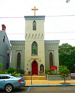
St. Johns Episcopal Church
-
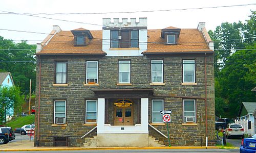
Huntingdon County Sheriff's Office
-
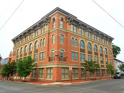
Building at 4th and Washington Streets
-
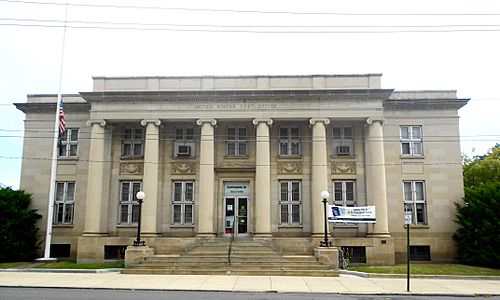
Post office


Geography
Huntingdon is located at 40°29′43″N 78°0′47″W / 40.49528°N 78.01306°W (40.495187, -78.013147).
 |
Tyrone | State College | Lewistown | |
| Altoona | McVeytown | |||
| Johnstown | Hollidaysburg | Harrisburg |
According to the United States Census Bureau, the borough has a total area of 3.5 square miles (9.1 km2), of which only 0.1 square miles (0.26 km2) (2.55%) is water.
Adjacent Municipalities
The following municipalities are also located in Huntingdon County, bordering on the Borough:
- Smithfield Township
- Henderson Township
- Oneida Township
Climate
| Climate data for Huntingdon, Pennsylvania | |||||||||||||
|---|---|---|---|---|---|---|---|---|---|---|---|---|---|
| Month | Jan | Feb | Mar | Apr | May | Jun | Jul | Aug | Sep | Oct | Nov | Dec | Year |
| Record high °F (°C) | 79 (26) |
77 (25) |
85 (29) |
95 (35) |
98 (37) |
100 (38) |
105 (41) |
105 (41) |
102 (39) |
97 (36) |
79 (26) |
73 (23) |
105 (41) |
| Average high °F (°C) | 38 (3) |
39 (4) |
50 (10) |
62 (17) |
74 (23) |
82 (28) |
85 (29) |
83 (28) |
78 (26) |
66 (19) |
52 (11) |
40 (4) |
62 (17) |
| Average low °F (°C) | 19 (−7) |
19 (−7) |
27 (−3) |
36 (2) |
46 (8) |
55 (13) |
59 (15) |
58 (14) |
51 (11) |
39 (4) |
31 (−1) |
22 (−6) |
39 (4) |
| Record low °F (°C) | −29 (−34) |
−23 (−31) |
−10 (−23) |
6 (−14) |
21 (−6) |
29 (−2) |
8 (−13) |
36 (2) |
24 (−4) |
13 (−11) |
−10 (−23) |
−22 (−30) |
−29 (−34) |
| Average precipitation inches (mm) | 2.8 (71) |
2.5 (64) |
3.5 (89) |
3.3 (84) |
3.8 (97) |
3.9 (99) |
3.9 (99) |
3.7 (94) |
3.0 (76) |
2.8 (71) |
2.6 (66) |
2.7 (69) |
38.5 (979) |
| Source: Weatherbase | |||||||||||||
Demographics
As of the census of 2010, there were 7,093 people, 2,674 households, and 1,461 families residing in the borough.
| Historical population | ||
|---|---|---|
| Year | Pop. | ±% p.a. |
| 1800 | 688 | — |
| 1810 | 676 | −0.18% |
| 1820 | 848 | +2.29% |
| 1840 | 1,145 | +1.51% |
| 1850 | 1,470 | +2.53% |
| 1860 | 1,890 | +2.54% |
| 1870 | 3,634 | +6.76% |
| 1880 | 4,125 | +1.28% |
| 1890 | 5,729 | +3.34% |
| 1900 | 6,053 | +0.55% |
| 1910 | 6,861 | +1.26% |
| 1920 | 7,051 | +0.27% |
| 1930 | 7,558 | +0.70% |
| 1940 | 7,170 | −0.53% |
| 1950 | 7,330 | +0.22% |
| 1960 | 7,234 | −0.13% |
| 1970 | 6,987 | −0.35% |
| 1980 | 7,042 | +0.08% |
| 1990 | 6,843 | −0.29% |
| 2000 | 6,918 | +0.11% |
| 2010 | 7,093 | +0.25% |
| 2020 | 6,827 | −0.38% |
| Sources: Source: |
||
The population density was 2,026.6 people per square mile (779.5/km²). There were 2,911 housing units at an average density of 831.7 per square mile (319.9/km²). The racial makeup of the borough was 94.61% White, 1.93% Black or African American, 0.07% Native American, 1.51% Asian, 0.31% from other races, and 1.56% from two or more races. Hispanic or Latino of any race were 1.49% of the population.
There were 2,674 households, out of which 26.2% had children under the age of 18 living with them, 38.2% were married couples living together, 4.1% had a male householder with no wife present, 12.4% had a female householder with no husband present, and 45.4% were non-families. 38.3% of all households were made up of individuals, and 15.6% had someone living alone who was 65 years of age or older. The average household size was 2.16 and the average family size was 2.82.
In the borough the population was spread out, with 17.7% under the age of 18, 24.4% from 18 to 24, 19.1% from 25 to 44, 22.4% from 45 to 64, and 16.4% who were 65 years of age or older. The median age was 33 years. For every 100 females, there were 87.5 males. For every 100 females age 18 and over, there were 85.3 males.
The median income for a household in the borough was $35,057, and the median income for a family was $54,621. The per capita income for the borough was $19,070. About 6.3% of families and 15.3% of the population were below the poverty line, including 8.9% of those under age 18 and 14.2% of those age 65 or over.
Annual Events
- Mayfest- historically-themed festival covering five city blocks in downtown Huntingdon
- Hauntingdon- compilation of events leading up to Halloween, such as the annual Halloween parade
- Veterans Day Parade- during the month of November to honor our veterans
- Tree Lighting Ceremony- during the first week of December at the corner of 5th & Penn Streets
- Cultural District Walking Tours- free tours provided by volunteers during the summer months

Non-Profit Organizations
- Rotary Club of Huntingdon (10305 Raystown Road)
- Kiwanis Club of Huntingdon (2506 Shadyside Avenue)
- Stone Creek Valley Lions Club (5303 Cold Springs Road)
- The Salvation Army (2514 Shadyside Avenue)
- Huntingdon Food Pantry (5th & Mifflin Street)
- Huntingdon House Domestic Violence Shelter (401 7th Street)
- Huntingdon County Humane Society (11371 School House Hollow Road)
Education
Higher education
- Juniata College (1700 Moore Street)
Public education
- Huntingdon Area Senior High School - opened in 1960 (renovated 2004) - Grades 9-12 (2400 Cassady Avenue)
- Huntingdon Area Middle School - opened in 2012 - Grades 6-8 (2500 Cassady Avenue)
- Southside Elementary School - opened in 1997 - Grades K-5 (10906 Station Road)
- Standing Stone Elementary School - opened in 1999 - Grades K-5 (10 West 29th Street)
Private education
- Calvary Christian Academy - Grades K-12 (300 Standing Stone Avenue)
See also
 In Spanish: Huntingdon (Pensilvania) para niños
