
Huron County, Michigan facts for kids
Quick facts for kids
Huron County
|
|
|---|---|

|
|

Location within the U.S. state of Michigan
|
|
 Michigan's location within the U.S. |
|
| Country | |
| State | |
| Founded | April 1, 1840 (created) January 25, 1859 (organized) |
| Named for | Lake Huron |
| Seat | Bad Axe |
| Largest city | Bad Axe |
| Area | |
| • Total | 2,137 sq mi (5,530 km2) |
| • Land | 836 sq mi (2,170 km2) |
| • Water | 1,301 sq mi (3,370 km2) 61%% |
| Population
(2020)
|
|
| • Total | 31,407 |
| • Density | 40/sq mi (20/km2) |
| Time zone | UTC−5 (Eastern) |
| • Summer (DST) | UTC−4 (EDT) |
| Congressional district | 10th |
Huron County is a county in the U.S. state of Michigan. As of the 2020 Census, the population was 31,407. The county seat is Bad Axe. Huron County is at the northern tip of the Thumb, which is a sub region of Mid Michigan. It is a peninsula, bordered by Saginaw Bay to the west and Lake Huron to the north and east, and has over 90 miles (140 km) of shoreline, from White Rock on Lake Huron to Sebewaing on the Saginaw Bay. Huron County's most important industry is agriculture, as with most of the other Thumb counties. Huron County enjoys seasonal tourism from large cities such as Detroit, Flint, and Saginaw. A lot of the tourism is in the Port Austin and Caseville area.
Contents
History
Huron County was originally attached to Sanilac and Tuscola counties. It was created by Michigan Law on April 1, 1840 and was fully organized by an Act of Legislature on January 25, 1859. Sand Beach (now Harbor Beach) was then county seat, until 1865, when the court house burned with nearly all the records. It was moved to Port Austin and remained there until 1873, when the Board of Supervisors permanently made Bad Axe the County Seat.
The name Huron was derived from the word "hures" as used in the phrase "In elles hures" (what heads) as applied by an astonished French traveler to the Wyandotte or Huron Indians on beholding their fantastic mode of dressing the hair. These Indians were dispersed by the Iroquois in 1649.
In the 17th and early 18th century in this region, the Thumb of Michigan, the suffix "onti" or "ondi" was used in place names such as Skenchioetontius and E. Kandechiondius. "Onti" means to jut out. The name Wyandotte, Huron descendants, was said to mean "dwellers of the peninsula". A headland or peninsula in Onondaga is "onoentoto".
In the early 18th century, the Thumb of Michigan was called the best beaver hunting in America, and the Detroit region was called Tio-sahr-ondion, which was near Skenchioe [now Huron and Sanilac Counties]. Tiosahrondion meant "where it is beaver dams athwart many".
About 1700, on French maps, "Chasse des caster des ami de Francois" was the region of Saginaw and the Thumb of Michigan. It meant the beaver hunting grounds of the friends of France.
Geography
According to the U.S. Census Bureau, the county has a total area of 2,137 square miles (5,530 km2), of which 836 square miles (2,170 km2) is land and 1,301 square miles (3,370 km2) (61%) is water.
Adjacent counties
- Sanilac County (southeast)
- Tuscola County (southwest)
Highways
 M-19 - runs north and south through the southern half of the county
 M-25 - runs along the outer edge of the county, along the shore of Lake Huron and Saginaw Bay
 M-53 - runs north and south through the central part of the county
- M-142 - runs east and west through the central part of the county
Demographics
| Historical population | |||
|---|---|---|---|
| Census | Pop. | %± | |
| 1850 | 210 | — | |
| 1860 | 3,165 | 1,407.1% | |
| 1870 | 9,049 | 185.9% | |
| 1880 | 20,089 | 122.0% | |
| 1890 | 28,545 | 42.1% | |
| 1900 | 34,162 | 19.7% | |
| 1910 | 34,758 | 1.7% | |
| 1920 | 32,768 | −5.7% | |
| 1930 | 31,132 | −5.0% | |
| 1940 | 32,584 | 4.7% | |
| 1950 | 33,149 | 1.7% | |
| 1960 | 34,006 | 2.6% | |
| 1970 | 34,083 | 0.2% | |
| 1980 | 36,459 | 7.0% | |
| 1990 | 34,951 | −4.1% | |
| 2000 | 36,079 | 3.2% | |
| 2010 | 33,118 | −8.2% | |
| 2020 | 31,407 | −5.2% | |
| US Decennial Census 1790-1960 1900-1990 1990-2000 2010-2018 |
|||
The 2010 United States Census indicates Huron County had a 2010 population of 33,118. This decrease of -2,961 people from the 2000 United States Census represents an 8.2% decrease. In 2010 there were 14,348 households and 9,328 families in the county. The population density was 39.6 per square mile (15.3 per km2). There were 21,199 housing units at an average density of 25.4 per square mile (9.8 per km2). 97.5% of the population were White, 0.4% Asian, 0.4% Black or African American, 0.3% Native American, 0.4% of some other race and 0.9% of two or more races. 2.0% were Hispanic or Latino (of any race). 41.1% were of German, 15.9% Polish, 6.8% Irish, 6.1% English and 6.0% American ancestry.
There were 14,348 households, out of which 24.7% had children under the age of 18 living with them, 52.7% were husband and wife families, 8.1% had a female householder with no husband present, 35.0% were non-families, and 30.7% were made up of individuals. The average household size was 2.27 and the average family size was 2.81.
In the county, the population was spread out, with 20.7% under age of 18, 6.4% from 18 to 24, 20.4% from 25 to 44, 30.8% from 45 to 64, and 21.7% who were 65 years of age or older. The median age was 47 years. For every 100 females there were 98.5 males. For every 100 females age 18 and over, there were 97.3 males.
The 2010 American Community Survey 3-year estimate indicates the median income for a household in the county was $38,789 and the median income for a family was $46,533. Males had a median income of $26,688 versus $15,198 for females. The per capita income for the county was $21,342. About 1.4% of families and 14.4% of the population were below the poverty line, including 19.7% of those under the age 18 and 10.4% of those age 65 or over.
Religion
- The United Methodist Church has a strong presence.
- The Roman Catholic Diocese of Saginaw is the controlling regional body for the Catholic Church.
- All Episcopal parishes are members of the Episcopal Diocese of Eastern Michigan
- The Church of Jesus Christ of Latter-day Saints has one meetinghouse in Huron County.
Parks and recreation
Tourism is also important to Huron County with bay front and lakefront towns such as Sebewaing, Caseville, Port Austin, Port Hope, and Harbor Beach, attracting tourists from all over. Huron County borders the Saginaw Bay and Lake Huron. There are two state parks – Sleeper State Park and Port Crescent State Park. Three roadside parks – Jenks Park, Brown Park, and White Rock Park. Also, Huron County maintains nine county parks along the shoreline, which are Caseville Park, Lighthouse Park, Stafford Park, McGraw Park, Philp Park, Port Austin Bird Creek Park, Wagener Park, Oak Beach Park, and Sebewaing Park.
Communities
Cities
- Bad Axe (county seat)
- Caseville
- Harbor Beach
Villages
Census-designated place
Other unincorporated communities
Source:
Townships
- Bingham Township
- Bloomfield Township
- Brookfield Township
- Caseville Township
- Chandler Township
- Colfax Township
- Dwight Township
- Fairhaven Township
- Gore Township
- Grant Township
- Hume Township
- Huron Township
- Lake Township
- Lincoln Township
- McKinley Township
- Meade Township
- Oliver Township
- Paris Township
- Pointe Aux Barques Township
- Port Austin Township
- Rubicon Township
- Sand Beach Township
- Sebewaing Township
- Sheridan Township
- Sherman Township
- Sigel Township
- Verona Township
- Winsor Township
Images for kids
-
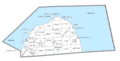
U.S. Census data map showing local municipal boundaries within Huron County. Shaded areas represent incorporated cities.

See also
 In Spanish: Condado de Huron (Míchigan) para niños
