
Image: 115th United States Congress Congressional Districts.pdf
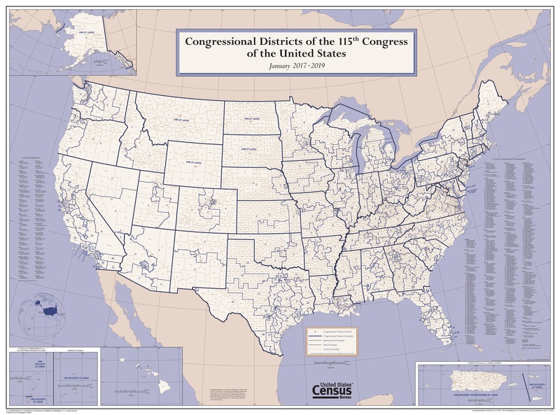
Size of this JPG preview of this PDF file: 800 × 593 pixels. Other resolution: 320 × 237 pixels.
Original image (6,675 × 4,950 pixels, file size: 18.44 MB, MIME type: application/pdf)
Description: This wall map depicts congressional district boundaries in effect for the 115th Congress of the United States (January 2017-2019). The map includes county names and boundaries for each state, the District of Columbia, Puerto Rico, American Samoa, Guam, the Commonwealth of the Northern Mariana Islands, and U.S. Virgin Islands. The map also includes a listing of the names of all members of the 115th Congress, as of January 10, 2017.
Usage Terms: Public domain
Image usage
The following page links to this image:

All content from Kiddle encyclopedia articles (including the article images and facts) can be freely used under Attribution-ShareAlike license, unless stated otherwise.