
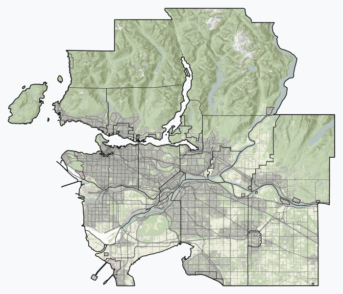
Image: 15 Metro Vancouver Regional District British Columbia

Size of this PNG preview of this SVG file: 700 × 600 pixels. Other resolution: 280 × 240 pixels.
Original image (SVG file, nominally 916 × 785 pixels, file size: 17.4 MB)
Description: Experimental SVG overview of British Columbia's regional districts, using open CEC Landsat-derived land cover data (2010) to generate a naturalistic colour scheme. More information here. Vector features are from Statistics Canada and BC Open Data. Indian reserves are depicted with a red shapeburst fill. Projection is Web Mercator (EPSG:3857). This graphic was created with QGIS
Title: 15 Metro Vancouver Regional District British Columbia
Credit: Own work
Author: awmcphee
Usage Terms: Creative Commons Zero, Public Domain Dedication
License: CC0
License Link: http://creativecommons.org/publicdomain/zero/1.0/deed.en
Attribution Required?: No
Image usage
The following 26 pages link to this image:
- Alaksen National Wildlife Area
- Barnston Island
- Barnston Island (British Columbia)
- Belcarra Regional Park
- Boundary Bay Wildlife Management Area
- Burnaby Lake Regional Park
- Capilano Lake
- Deer Lake (British Columbia)
- Elsay Lake
- English Bay, Vancouver
- Gastown
- Granville Entertainment District
- Hinge Park
- Hollow Tree
- Lynn Canyon Park
- Mount Bishop (Fannin Range)
- Mount Elsay
- Mount Seymour
- Mount Seymour Provincial Park
- Pacific Central Station
- Passage Island (British Columbia)
- Queen Charlotte Channel (British Columbia)
- Richmond Nature Park
- Second Beach (Vancouver)
- The Lions (peaks)
- Unitarian Church of Vancouver

All content from Kiddle encyclopedia articles (including the article images and facts) can be freely used under Attribution-ShareAlike license, unless stated otherwise.