
Image: 170825-N-N0101-502 (36086497114)
Size of this preview: 600 × 600 pixels. Other resolutions: 240 × 240 pixels | 1,024 × 1,024 pixels.
Original image (1,024 × 1,024 pixels, file size: 395 KB, MIME type: image/jpeg)
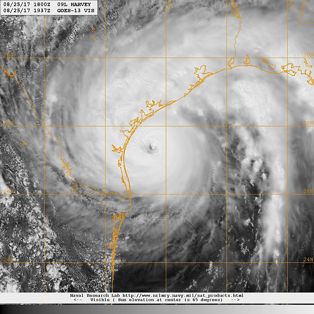
Description: 170825-N-N0101-502 GULF OF MEXICO (Aug. 25, 2017) A GOES-13 satellite image from the Naval Research Laboratory taken at 3:07 p.m. EST shows Hurricane Harvey approaching the Texas coast moving north-northwest at 10 mph. The National Hurricane Center has upgraded the storm to a Category 3 storm with maximum sustained winds reaching than 120 mph. Forecasters expect up to 36 inches of rain in some areas as the storm makes landfall along the southern coast of Texas Friday evening. (U.S. Navy photo/Released)
Title: 170825-N-N0101-502 (36086497114)
Credit: 170825-N-N0101-502
Author: NAVFAC
Usage Terms: Public domain
License: Public domain
Attribution Required?: No
Image usage
The following page links to this image:

All content from Kiddle encyclopedia articles (including the article images and facts) can be freely used under Attribution-ShareAlike license, unless stated otherwise.
.jpg)