
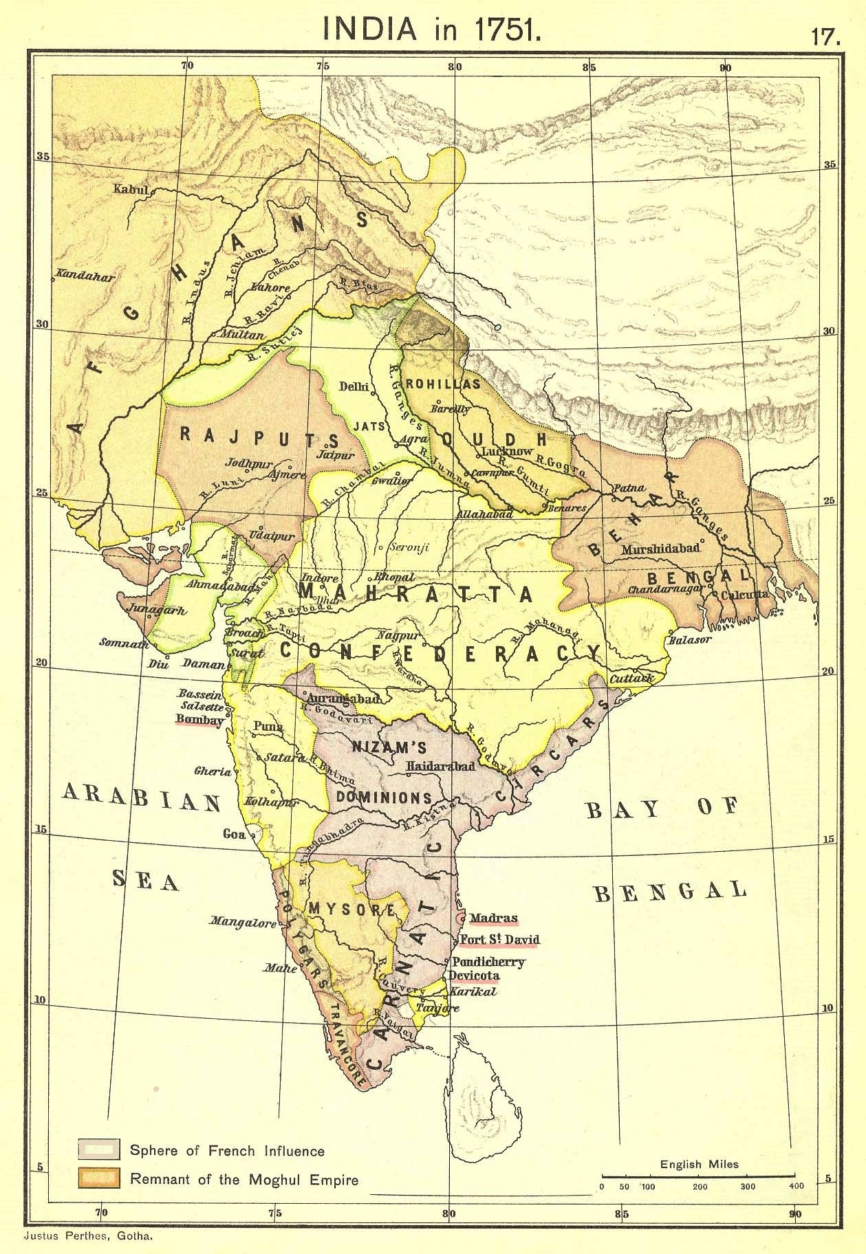
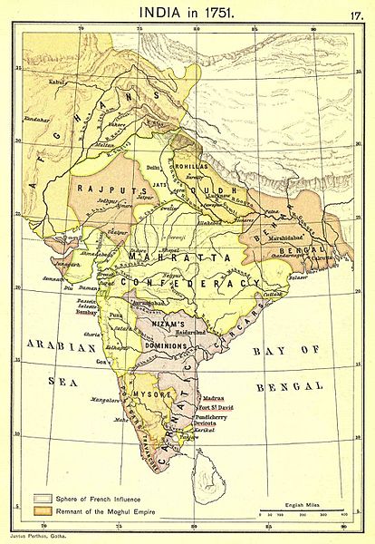
Image: 1751 map of India from "Historical Atlas of India", by Charles Joppen
Size of this preview: 414 × 600 pixels. Other resolutions: 166 × 240 pixels | 1,259 × 1,824 pixels.
Original image (1,259 × 1,824 pixels, file size: 689 KB, MIME type: image/jpeg)
Description: Political map of India in 1751, at the height of French influence in India. Map from the Historical Atlas of India, by Charles Joppen (London: Longmans, Green & Co., 1907)
Title: 1751 map of India from "Historical Atlas of India", by Charles Joppen
Credit: Columbia.edu
Author: Charles Joppen
Usage Terms: Public domain
License: Public domain
Attribution Required?: No
Image usage
The following 2 pages link to this image:

All content from Kiddle encyclopedia articles (including the article images and facts) can be freely used under Attribution-ShareAlike license, unless stated otherwise.