
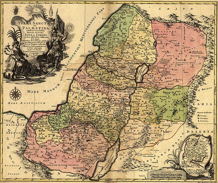
Image: 1759 map Holy Land and 12 Tribes

Size of this preview: 715 × 599 pixels. Other resolutions: 286 × 240 pixels | 2,000 × 1,676 pixels.
Original image (2,000 × 1,676 pixels, file size: 1.74 MB, MIME type: image/jpeg)
Description: English Translation: The Holy Land or Palestine showing not only the Old Kingdoms of Judea and Israel but also the 12 Tribes Distinctly, Confirming their Locations Diversely in their Ancient Condition and Doing So as the Holy Scriptures Indicate.
Title: Latina: Terra Sancta sive Palæstina exhibens no ſolum Regna vetera Iuda et Israel in ſuas XII Tribus diſtincta, ſed etiam eorundem diverſarum ætatum conditionem et facta in Sacris Paginis idicata.
Credit: Geography and Map Division, Library of Congress
Author: Tobias Lotter
Usage Terms: Public domain
License: Public domain
Attribution Required?: No
Image usage
The following 2 pages link to this image:

All content from Kiddle encyclopedia articles (including the article images and facts) can be freely used under Attribution-ShareAlike license, unless stated otherwise.