
Image: 1785 Land Ordinance Diagram
Size of this preview: 603 × 599 pixels. Other resolutions: 241 × 240 pixels | 1,800 × 1,789 pixels.
Original image (1,800 × 1,789 pixels, file size: 1.12 MB, MIME type: image/jpeg)
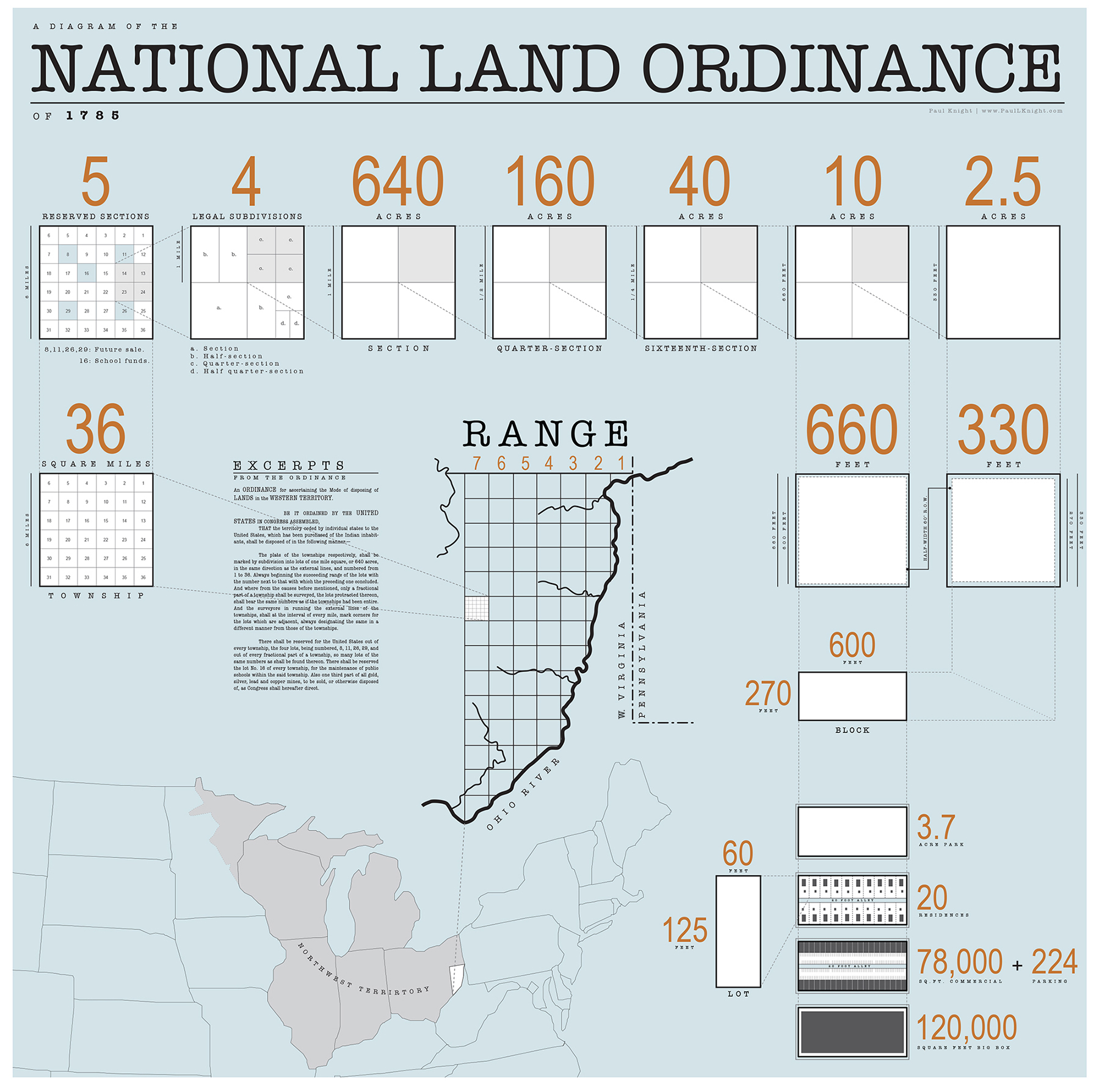
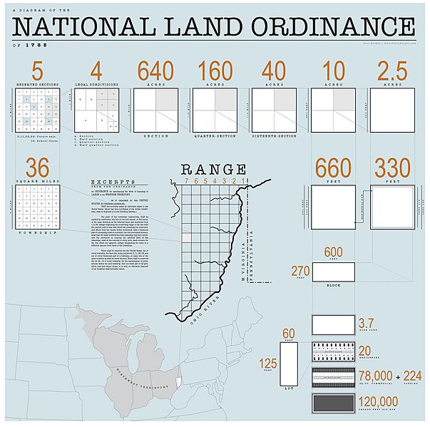
Description: Diagram of the 1785 Land Ordinance showing how the method of subdivision can be applied from the scale of the country down to the scale of a single lot.
Title: 1785 Land Ordinance Diagram
Credit: Own work
Author: Isomorphism3000
Usage Terms: Creative Commons Attribution-Share Alike 3.0
License: CC BY-SA 3.0
License Link: https://creativecommons.org/licenses/by-sa/3.0
Attribution Required?: Yes
Image usage
The following page links to this image:

All content from Kiddle encyclopedia articles (including the article images and facts) can be freely used under Attribution-ShareAlike license, unless stated otherwise.