
Image: 1820s Early map showing Milson's residence

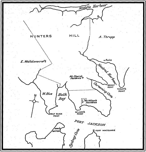
Description: A sketch map first published in 1955 in the book "The Life and Times of James Milson" shows the approximate extent of "Mr Milson's Residence", orchard and dairy in the 1820s in the location of the modern Jeffrey Street, Kirribilli which was leased by Milson from Robert Campbell. It also shows the approximate extent of the full 120 acres (48ha) owned by Robert Campbell which was leased by Milson in the 1820s. By the 1840s Milson no longer leased the majority of Campbell's 120 acres (48ha), but continued to lease the orchard and dairy. Also shown is the approximate boundary with the adjoining 50 acres (20ha) granted to Milson in 1825, and on which he built his residence in 1831. This sketch map is not an early map, and not from the 1820s, which is demonstrated by the spelling of the surname as "Milson" when early maps and documents spell the surname as "Milsom".
Title: 1820s Early map showing Milson's residence
Credit: Originally cited to "The Life and Times of James Milson" (R. H. Goddard, Melbourne, 1955), reprinted in Pictorial History, Lower North Shore in chapter titled "Thrupp's Acres" (Warne, Catherine (1984) Kingsclear Books Pty Ltd. ISBN 0-908272-83-9)
Usage Terms: Public domain
License: Public domain
Attribution Required?: No
Image usage
The following page links to this image:
