
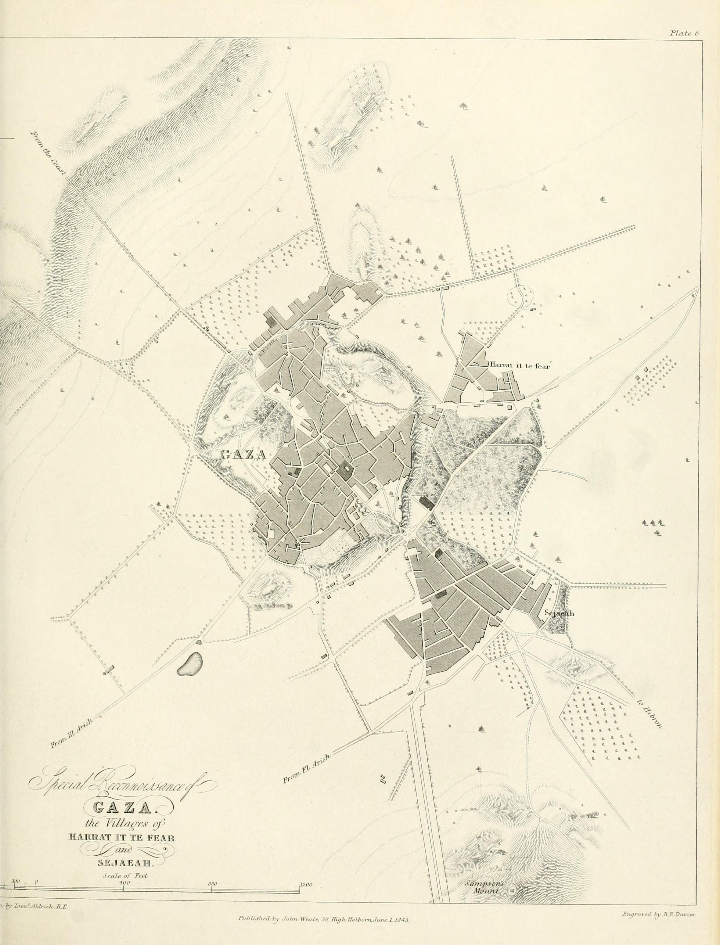
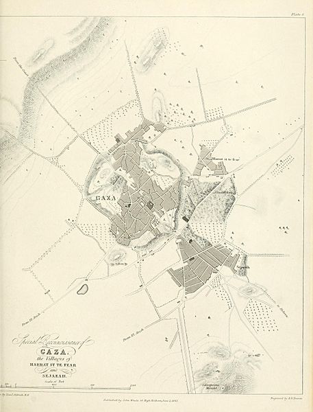
Image: 1840–41 Royal Engineers map of Gaza
Size of this preview: 457 × 600 pixels. Other resolutions: 183 × 240 pixels | 2,360 × 3,098 pixels.
Original image (2,360 × 3,098 pixels, file size: 694 KB, MIME type: image/jpeg)
Description: 1840–41 Royal Engineers map of Gaza
Title: 1840–41 Royal Engineers map of Gaza
Credit: https://archive.org/details/papersonsubjects06grea/page/n97 Papers on subjects connected with the duties of the Corps Volume 6 1843 Chapter 3: Notes on Acre and some of the Coast Defences of Syria by Ralph Carr Alderson Pages 19-62
Author: UK Government - Royal Engineers Corps
Usage Terms: Public domain
License: Public domain
Attribution Required?: No
Image usage
The following page links to this image:

All content from Kiddle encyclopedia articles (including the article images and facts) can be freely used under Attribution-ShareAlike license, unless stated otherwise.