
Image: 1842NSWArrowsmith
No higher resolution available.
1842NSWArrowsmith.jpg (500 × 410 pixels, file size: 24 KB, MIME type: image/jpeg)
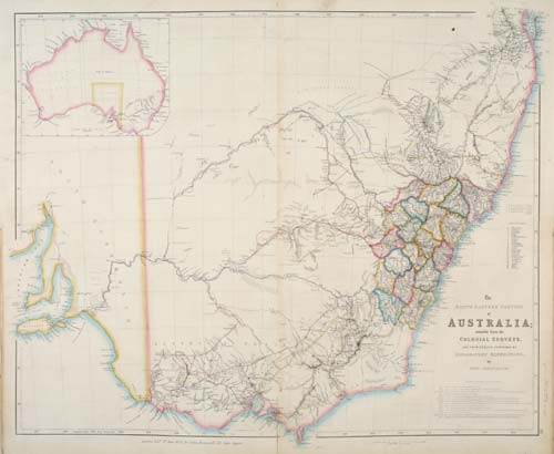
Description: The South Eastern Portion of Australia; compiled from the Colonial Surveys, and from details furnished by Exploratory Expeditions. London, 1842. 535 x 645mm. Original colour. Detailed map of New South Wales, issued in the 'London Atlas' by John Arrowsmith, the foremost British cartographer of his generation. The newly formed counties are marked (see Nineteen Counties) as are the inland expeditions made 1817-1840. ARRO0011
Title: 1842NSWArrowsmith
Credit: http://www.leejacksonmaps.com/aust.htm#ARRO0011
Author: John Arrowsmith (1790-1873)
Permission: Public Domain - more than 100 years old
Usage Terms: Public domain
License: Public domain
Attribution Required?: No
Image usage
The following page links to this image:

All content from Kiddle encyclopedia articles (including the article images and facts) can be freely used under Attribution-ShareAlike license, unless stated otherwise.