
Image: 1842 Okkuddo Cheonoquet Anamickee Shawwano Oscoda Negwegon counties Michigan
Size of this preview: 800 × 520 pixels. Other resolutions: 320 × 208 pixels | 810 × 527 pixels.
Original image (810 × 527 pixels, file size: 489 KB, MIME type: image/jpeg)
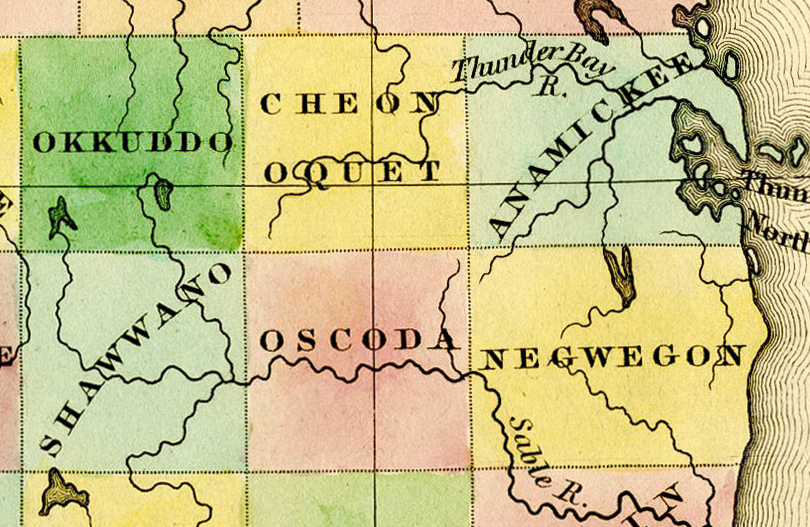
Description: Detail of A New Map of Michigan With Its Canals, Roads & Distances by H.S. Tanner, 1842, showing: Okkuddo County (later renamed Otsego County) Cheonoquet County (later renamed Montmorency County) Anamickee County (later renamed Alpena County) Shawono County (misspelled "Shawwano") (later renamed Crawford County) Oscoda County Negwegon County (later renamed Alcona County)
Title: 1842 Okkuddo Cheonoquet Anamickee Shawwano Oscoda Negwegon counties Michigan
Credit: File:1842 A new map of Michigan with its canals roads distances by H.S. Tanner.jpg
Author: Henry Schenck Tanner
Usage Terms: Public domain
License: Public domain
Attribution Required?: No
Image usage
The following 3 pages link to this image:

All content from Kiddle encyclopedia articles (including the article images and facts) can be freely used under Attribution-ShareAlike license, unless stated otherwise.