
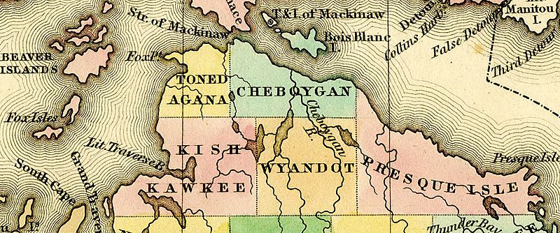
Image: 1842 Tonedagana Cheboygan Kishkawkee Wyandot PresqueIsle counties Michigan

Size of this preview: 800 × 334 pixels. Other resolutions: 320 × 134 pixels | 1,225 × 512 pixels.
Original image (1,225 × 512 pixels, file size: 766 KB, MIME type: image/jpeg)
Description: Detail of A New Map of Michigan With Its Canals, Roads & Distances by H.S. Tanner, 1842, showing: Tonedagana County (later renamed Emmet County) Cheboygan County Keskkauko County (misspelled "Kishkawkee") (later renamed Charlevoix County) Wyandot County (later eliminated and annexed to Cheboygan County) Presque Isle County
Title: 1842 Tonedagana Cheboygan Kishkawkee Wyandot PresqueIsle counties Michigan
Credit: File:1842 A new map of Michigan with its canals roads distances by H.S. Tanner.jpg
Author: Henry Schenck Tanner
Usage Terms: Public domain
License: Public domain
Attribution Required?: No
Image usage
The following page links to this image:

All content from Kiddle encyclopedia articles (including the article images and facts) can be freely used under Attribution-ShareAlike license, unless stated otherwise.