
Image: 1884 Sanborn Fire Insurance Map - St. Raphael's Cathedral property - Dubuque, Iowa
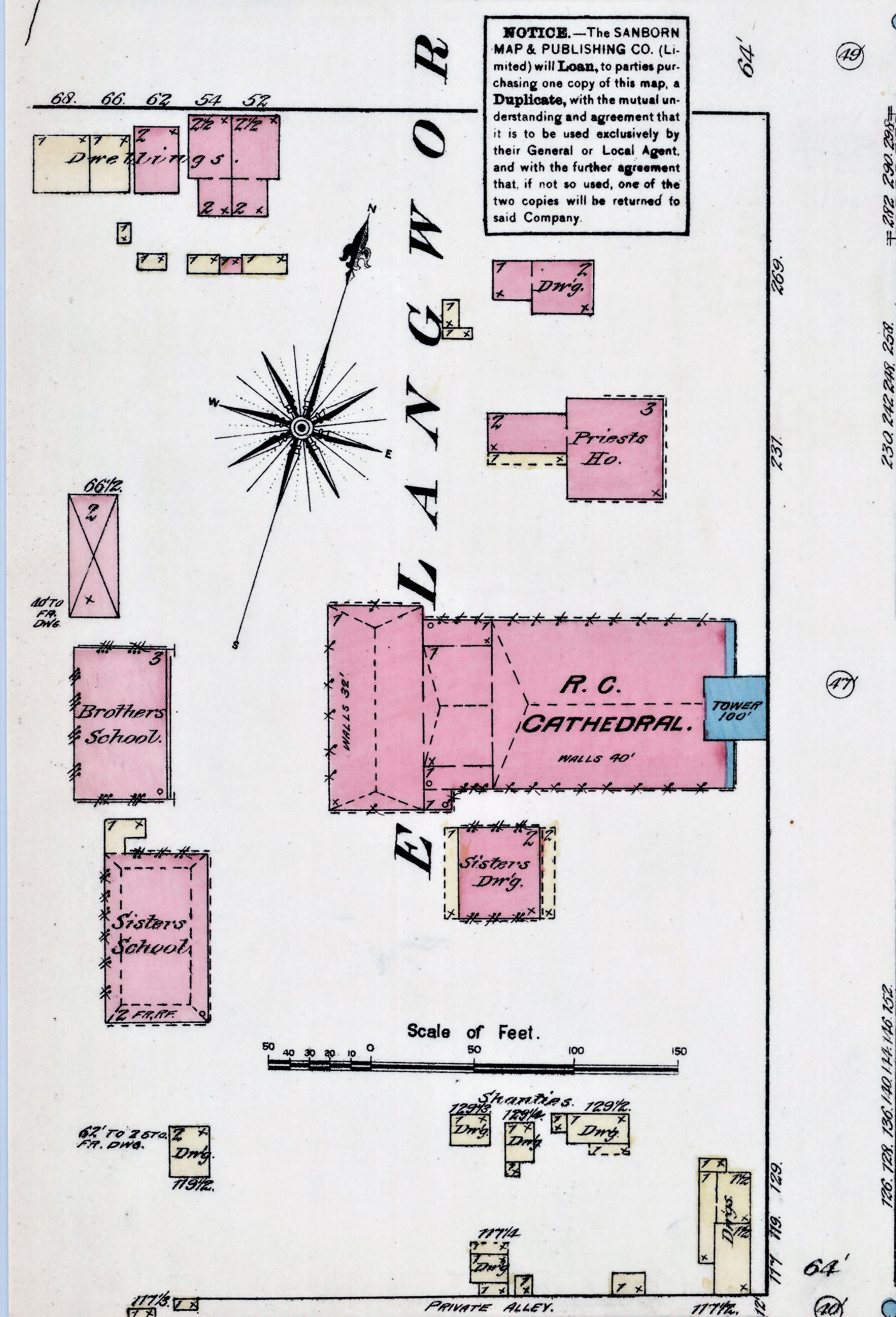
Description: An 1884 Sanborn Fire Insurance Map cropped to show the property of St. Raphael's Cathedral in Dubuque, Iowa, United States. The cathedral is in the center (pink, tower in blue). The rectory is located immediately to the north of the cathedral and another dwelling, no longer extant, is shown above it. The convent, no longer extant, is below the cathedral on the location of the future parish school. The boy's school, no longer extant, and the girl's school building, which became the convent, are located behind the cathedral. Emmet Street, which does not exist at this date, was built in front of the girl's school building (future convent). The dwellings at the bottom of the block are listed as shanties and could possibly be some of the residences along Emmet Street now. There continue to be dwellings at the top left corner of the property today.
Title: 1884 Sanborn Fire Insurance Map - St. Raphael's Cathedral property - Dubuque, Iowa
Credit: File:Sanborn Fire Insurance Map from Dubuque, Dubuque County, Iowa. LOC sanborn02633 001-12.jpg
Author: Unknown authorUnknown author
Permission: This map is available from the United States Library of Congress's Geography & Map Division under the digital ID g4154dm.g026331884. This tag does not indicate the copyright status of the attached work. A normal copyright tag is still required. See Commons:Licensing for more information.
Usage Terms: Public domain
License: Public domain
Attribution Required?: No
Image usage
The following page links to this image:
