
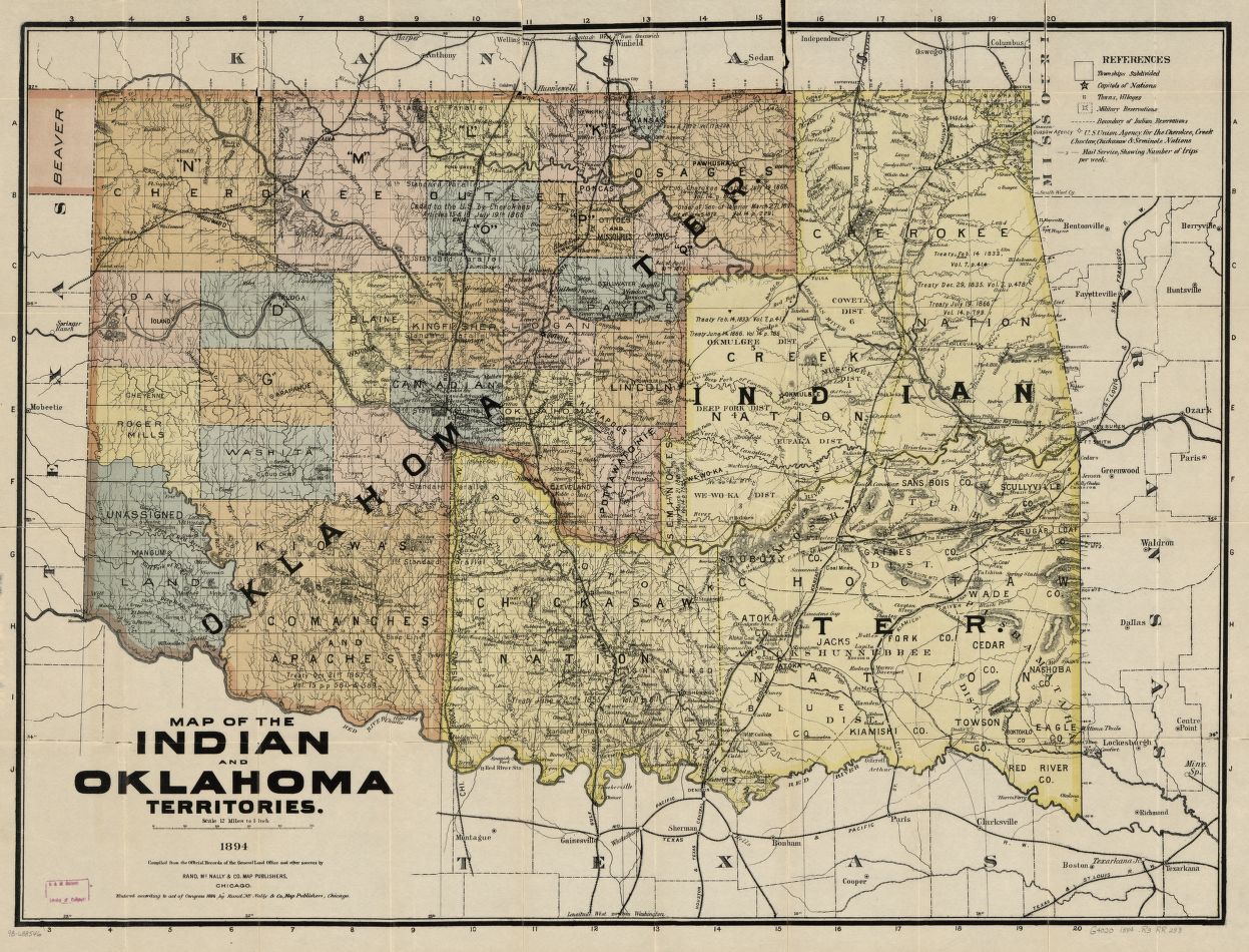
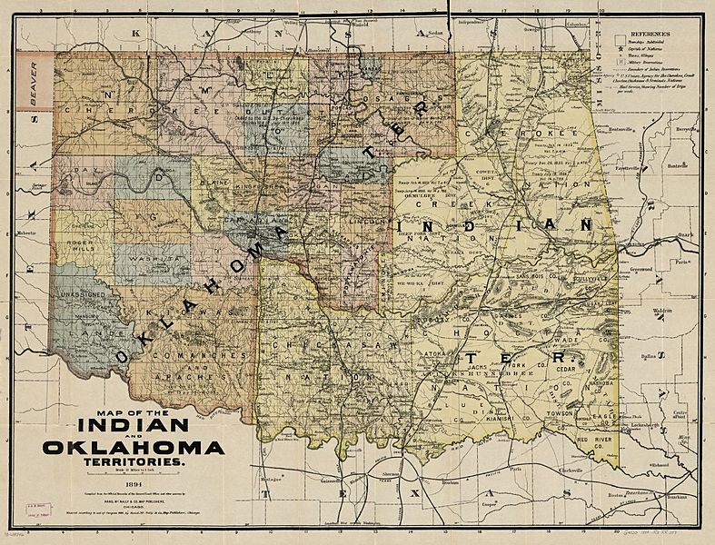
Image: 1894 Map of Indian & Oklahoma Terrs
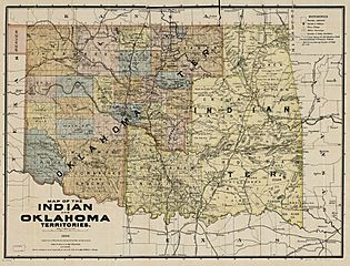
Size of this preview: 787 × 600 pixels. Other resolutions: 315 × 240 pixels | 1,247 × 950 pixels.
Original image (1,247 × 950 pixels, file size: 370 KB, MIME type: image/jpeg)
Description: Map of Indian Territory and Oklahoma Territory in 1894, showing political subdivisions existing then. Both Territories ceased to exist November 16, 1907, when the State of Oklahoma became effective.
Title: 1894 Map of Indian & Oklahoma Terrs
Credit: Library of Congress
Author: Individual unidentified; map dated 1894
Usage Terms: Public domain
License: Public domain
Attribution Required?: No
Image usage
The following 2 pages link to this image:

All content from Kiddle encyclopedia articles (including the article images and facts) can be freely used under Attribution-ShareAlike license, unless stated otherwise.