
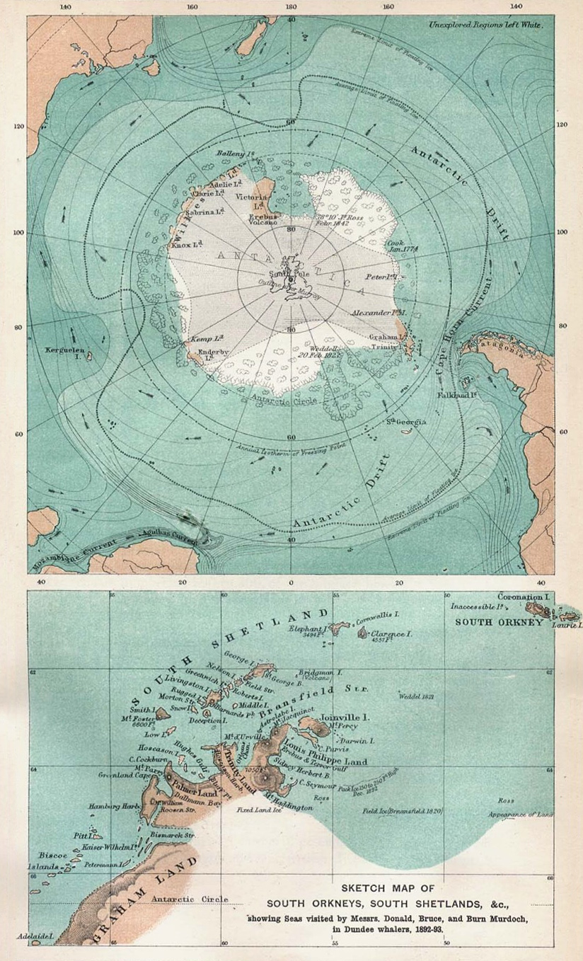
Image: 1894 map of Antactica
Size of this preview: 364 × 600 pixels. Other resolutions: 145 × 240 pixels | 824 × 1,358 pixels.
Original image (824 × 1,358 pixels, file size: 541 KB, MIME type: image/jpeg)
Description: Sketch map of south polar region, 1894
Title: 1894 map of Antactica
Credit: Scottish Geographical Magazine 1894 Vol. X No. 2
Author: Unknown
Usage Terms: Public domain
License: Public domain
Attribution Required?: No
Image usage
The following page links to this image:

All content from Kiddle encyclopedia articles (including the article images and facts) can be freely used under Attribution-ShareAlike license, unless stated otherwise.