
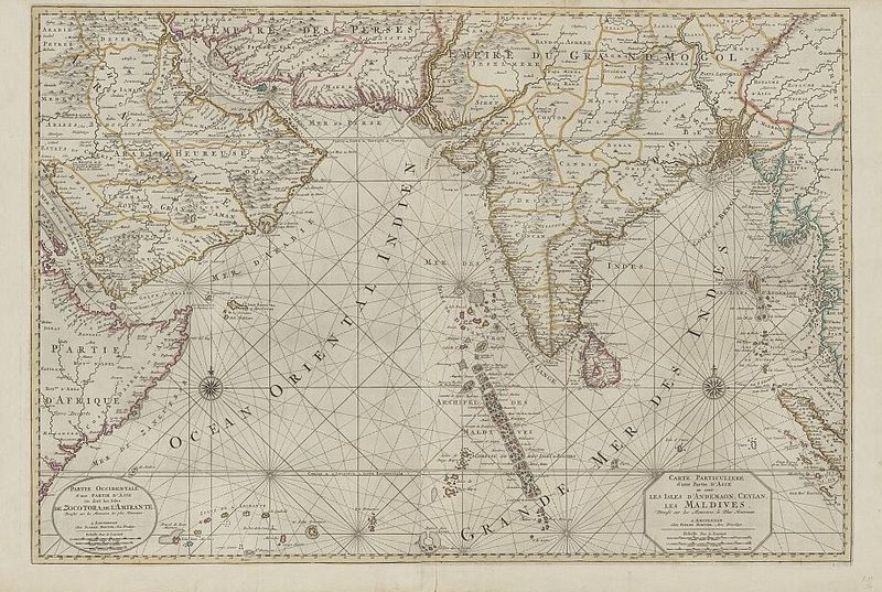
Image: 18th-century Maldives map by Pierre Mortier

Size of this preview: 800 × 537 pixels. Other resolutions: 320 × 215 pixels | 920 × 617 pixels.
Original image (920 × 617 pixels, file size: 237 KB, MIME type: image/jpeg)
Description: This detail from an 18th-century map by Pierre Mortier of The Netherlands names several dozen of the Maldive Islands off the southwestern coast of India. Map title: Carte particuliere d'une partie d'Asie ou sont les Isles d'Andemaon, Ceylan, les Maldives: dressé sur les memoires le plus nouveaux.
Title: 18th-century Maldives map by Pierre Mortier
Credit: http://catalogue.nla.gov.au/Record/3415503, which says "Probably from: Suite du Neptune François ou Atlas nouveau des cartes Marines / Pierre Mortier. Amsterdam : Chez Pierre Mortier, 1700."
Author: Pierre Mortier of The Netherlands
Usage Terms: Public domain
License: Public domain
Attribution Required?: No
Image usage
The following page links to this image:

All content from Kiddle encyclopedia articles (including the article images and facts) can be freely used under Attribution-ShareAlike license, unless stated otherwise.