
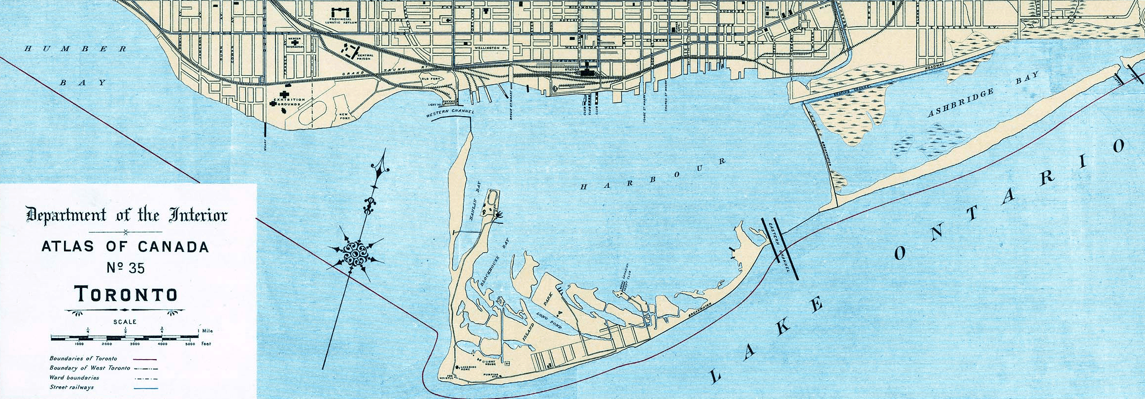
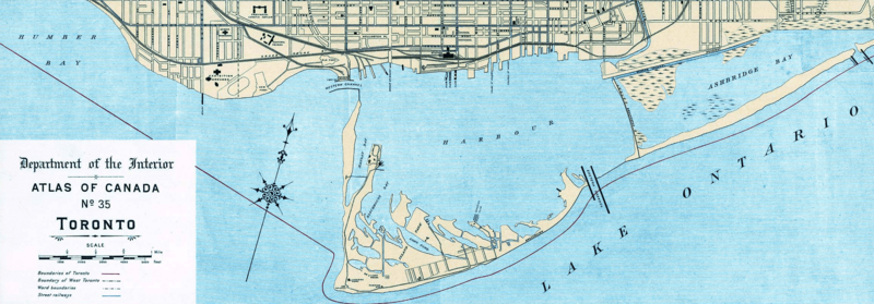
Image: 1906 Toronto Harbour map
Size of this preview: 800 × 279 pixels. Other resolutions: 320 × 112 pixels | 2,324 × 811 pixels.
Original image (2,324 × 811 pixels, file size: 2.87 MB, MIME type: image/png)
Description: Excerpt of 1906 Canadian national atlas map of Toronto, showing Toronto harbour.
Title: 1906 Toronto Harbour map
Credit: Excerpt of 1906 map from atlas
Author: Canadian Federal Government
Permission: Public domain works must be out of copyright in both the United States and in the source country of the work in order to be hosted on the Commons. If the work is not a U.S. work, the file must have an additional copyright tag indicating the copyright status in the source country. PD-1923Public domain in the United States//commons.wikimedia.org/wiki/File:1906_Toronto_Harbour_map.png
Usage Terms: Public domain
License: Public domain
Attribution Required?: No
Image usage
The following 2 pages link to this image:

All content from Kiddle encyclopedia articles (including the article images and facts) can be freely used under Attribution-ShareAlike license, unless stated otherwise.