
Image: 1942 map of the world showing the British Commonwealth of Nations

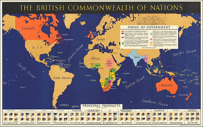
Description: Rare separately issued pictorial map of the world, published during World War II by the British Information Services. At the bottom, the map presents a pictorial image of the resources, agriculture and manufacturing specialties throughout the British Commonwealth. A second box provides a color coding describing the types of governments in each country, including "Condominiums and Mandated Territories." The British Information Services (BIS) was the New York based information department of the British Consulate in New York, an overseas post of the Foreign & Commonwealth Office, London. There were also offices of the BIS in Chicago, San Francisco, Los Angeles and in Ottawa. The map is quite rare. This is the first example we have ever seen this map.
Title: 1942 map of the world showing the British Commonwealth of Nations
Credit: https://www.raremaps.com/gallery/detail/61908/the-british-commonwealth-of-nations-british-information-services
Author: British Information Services
Usage Terms: Public domain
License: Public domain
Attribution Required?: No
Image usage
The following page links to this image:
