
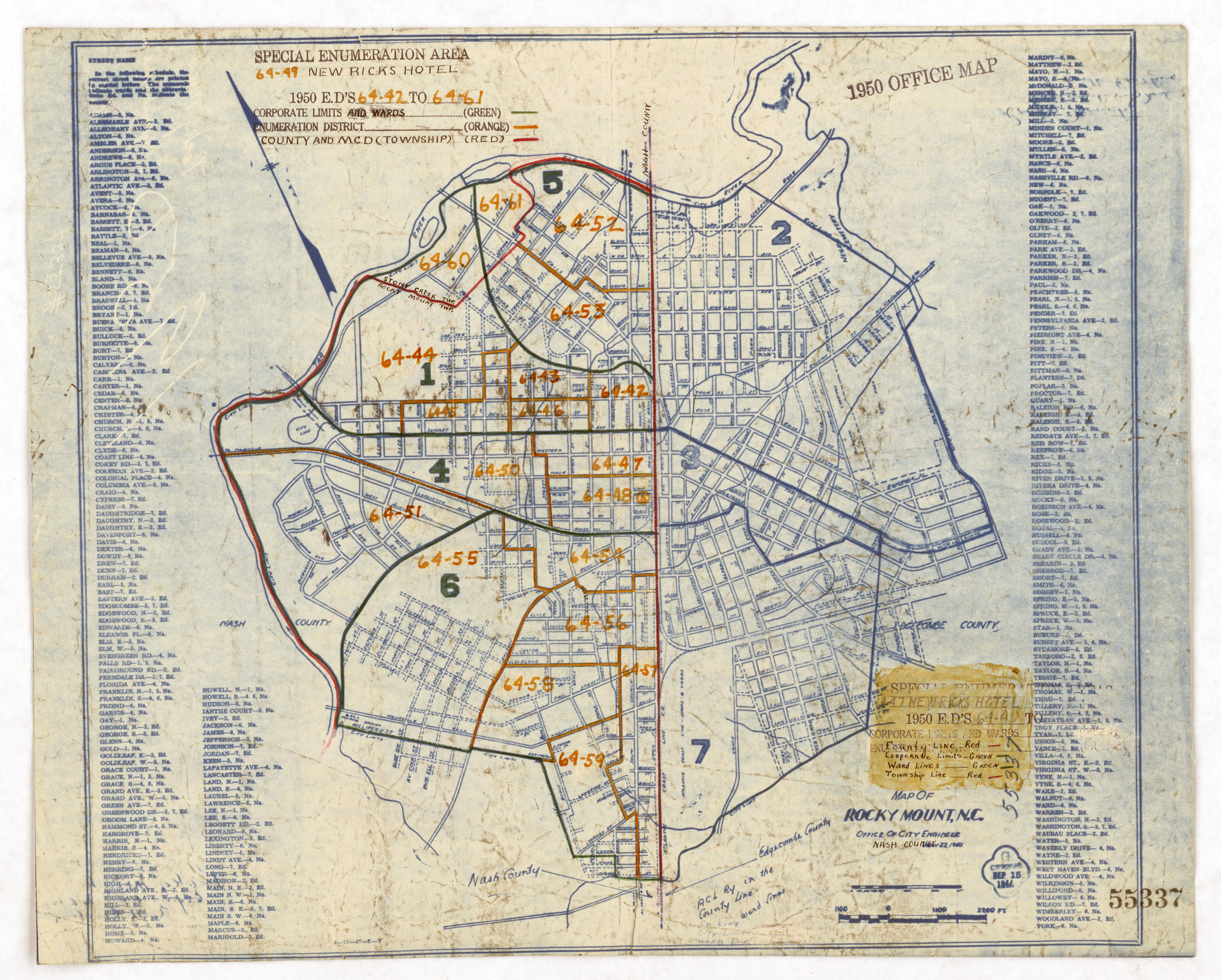
Image: 1950 Census Enumeration District Maps - North Carolina (NC) - Nash County - Rocky Mount - ED 64-42 to 61 - NARA - 22117974
Size of this preview: 747 × 599 pixels. Other resolutions: 299 × 240 pixels | 6,703 × 5,378 pixels.
Original image (6,703 × 5,378 pixels, file size: 5.16 MB, MIME type: image/jpeg)
Title: 1950 Census Enumeration District Maps - North Carolina (NC) - Nash County - Rocky Mount - ED 64-42 to 61
Credit: U.S. National Archives and Records Administration
Author: Unknown authorUnknown author or not provided
Usage Terms: Public domain
License: Public domain
Attribution Required?: No
Image usage
The following page links to this image:

All content from Kiddle encyclopedia articles (including the article images and facts) can be freely used under Attribution-ShareAlike license, unless stated otherwise.
_-_Nash_County_-_Rocky_Mount_-_ED_64-42_to_61_-_NARA_-_22117974.jpg)