
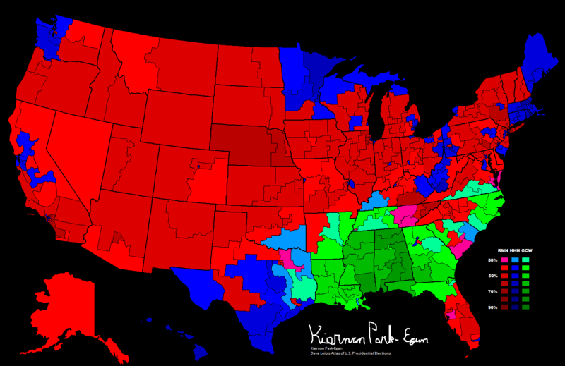
Image: 1968 Presidential Election, Results by Congressional District

Size of this preview: 800 × 519 pixels. Other resolutions: 320 × 208 pixels | 1,514 × 982 pixels.
Original image (1,514 × 982 pixels, file size: 89 KB, MIME type: image/png)
Description: This map shows the 1968 Presidential Results by 1968 Congressional Districts (except for New York, which uses 1970 districts in this case, due to availability issues)
Title: 1968 Presidential Election, Results by Congressional District
Credit: Drew it on Paint. Previously published: On Daily Kos (http://www.dailykos.com/story/2013/02/09/1185773/-Historical-Congressional-Maps) and Dave Leip's Atlas Forum (http://uselectionatlas.org/FORUM/index.php?topic=137677.950)
Author: Fuzzybf
Usage Terms: Creative Commons Attribution-Share Alike 3.0
License: CC BY-SA 3.0
License Link: http://creativecommons.org/licenses/by-sa/3.0
Attribution Required?: Yes
Image usage
The following page links to this image:

All content from Kiddle encyclopedia articles (including the article images and facts) can be freely used under Attribution-ShareAlike license, unless stated otherwise.