
Image: 2008prescountymap

Size of this preview: 800 × 520 pixels. Other resolutions: 320 × 208 pixels | 1,513 × 983 pixels.
Original image (1,513 × 983 pixels, file size: 176 KB, MIME type: image/png)
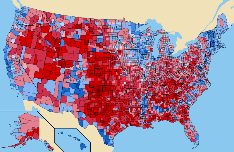
Description: Popular vote by county. Red represents counties that went for McCain, Blue represents counties that went for Obama. Connecticut, Hawaii, Massachusetts, New Hampshire, Rhode Island, and Vermont had all counties go to Obama. Oklahoma had all counties go to McCain.
Title: 2008prescountymap
Credit: Own work (Original caption: “Own work by uploader”) data, coloring, and inspiration from http://uselectionatlas.org
Author: Tilden76 at English Wikipedia
Usage Terms: Creative Commons Attribution 3.0
License: CC BY 3.0
License Link: http://creativecommons.org/licenses/by/3.0
Attribution Required?: Yes
Image usage
The following page links to this image:

All content from Kiddle encyclopedia articles (including the article images and facts) can be freely used under Attribution-ShareAlike license, unless stated otherwise.