
Image: 2011 Flooding in Brisbane Suburbs

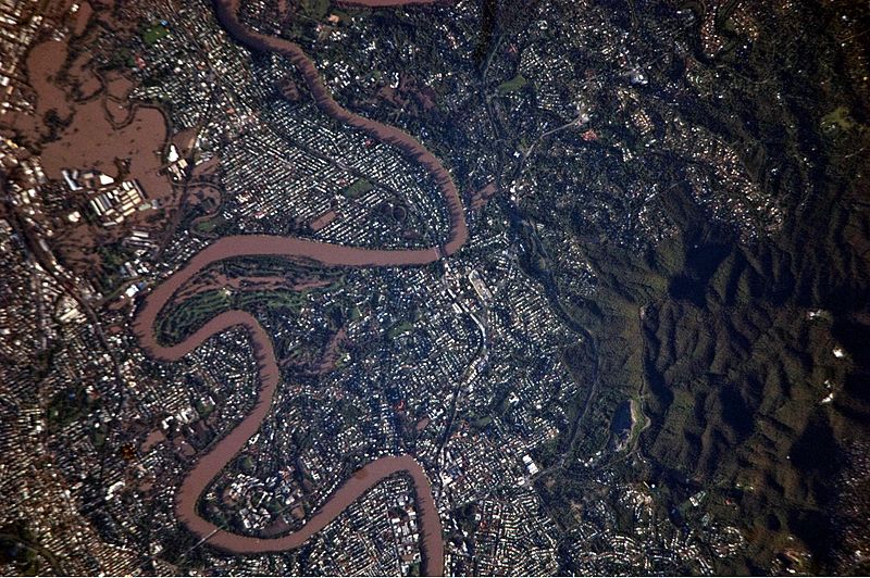
Description: This detailed satellite photograph illustrates flooding in metropolitan suburbs of the Brisbane, Queensland, Australia. Please note that the top of the photo is oriented approximately to the South-West and not to the North. The image, taken by astronauts on board the International Space Station, highlights several suburbs along the Brisbane River in the southern part of the Brisbane metropolitan area. The light-coloured rooftops of residences and other structures contrast sharply with green vegetation and brown, sediment laden flood-waters. Most visible low-lying areas are inundated by flood-water, perhaps the most striking being Rocklea at image upper left. The suburb of Yeronga (image lower left) also has evident regions of flooding, as does a park and golf course located along a bend in the Brisbane River to the south of St. Lucia (image center). Flooding becomes less apparent near the higher elevations of Mt. Coot-Tha at image right.
Title: 2011 Flooding in Brisbane Suburbs
Credit: NASA Earth Observatory
Author: ISS Expedition 26 crew
Usage Terms: Public domain
License: Public domain
Attribution Required?: No
Image usage
The following 3 pages link to this image:
