
Image: 2012-NL-prov-relief-3000
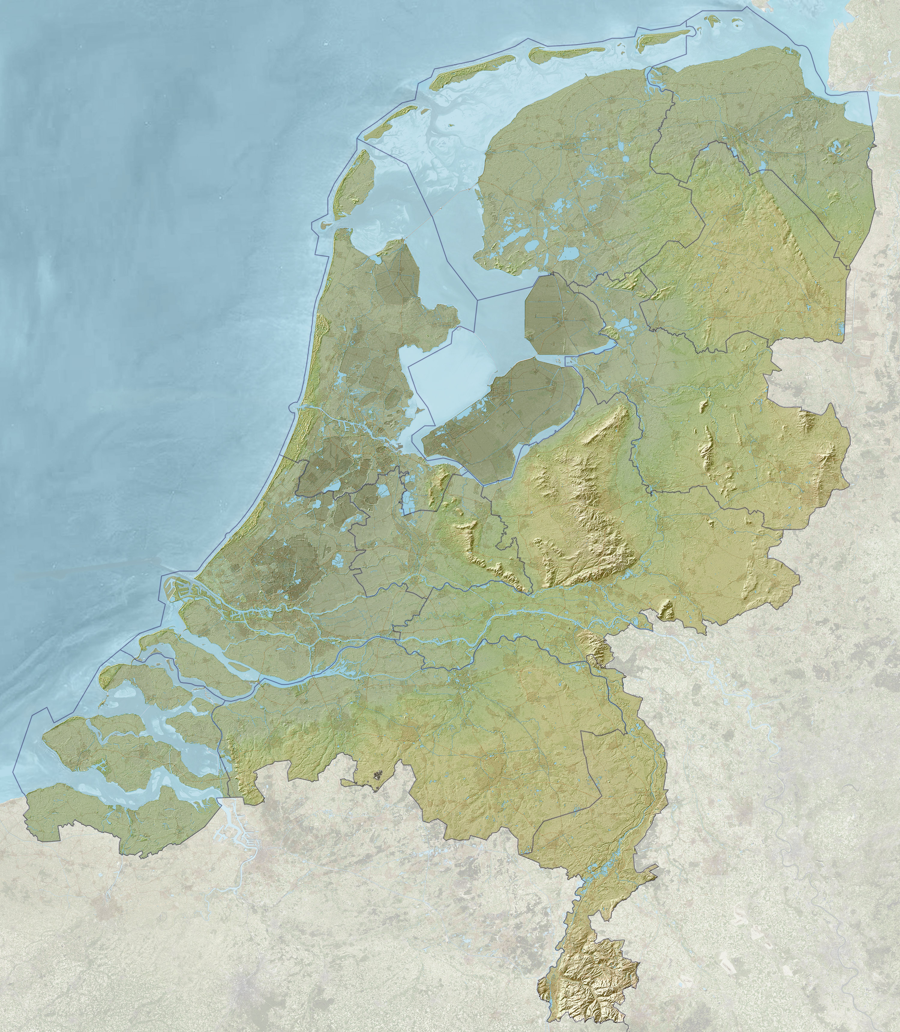
Description: Map of the Netherlands with relief and depth, including provincial borders. Cities and motorways are faintly visible through the relief image for orientation purposes. The terrain height varies from approximately −7 meter (−23 ft; below sea level, dark green) to approximately 322.7 meter (1,059 ft; above sea level, light green). Used data from public sources: Edited reference background on water from http://satfoto.geoserve.nl/false-nl/index.html. Usage is free with acknowledgements to NLR and ESA. Rasterized relief from the AHN Viewer (http://www.ahn.nl/kaart/); usage is free with acknowledgement (c) AHN, www.ahn.nl.
Title: 2012-NL-prov-relief-3000
Credit: Own work
Author: Janwillemvanaalst
Usage Terms: Creative Commons Attribution-Share Alike 3.0
License: CC BY-SA 3.0
License Link: http://creativecommons.org/licenses/by-sa/3.0
Attribution Required?: Yes
Image usage
The following page links to this image:
