
Image: 2016 Connecticut Drought Map

Size of this preview: 776 × 600 pixels. Other resolutions: 311 × 240 pixels | 1,056 × 816 pixels.
Original image (1,056 × 816 pixels, file size: 25 KB, MIME type: image/png)
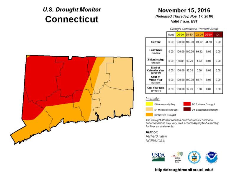
Description: A map of the 2016 drought, data is from 11-15-16.
Title: 2016 Connecticut Drought Map
Credit: United States Drought Monitor
Author: U.S. Department of Agricultural
Usage Terms: Public domain
License: Public domain
Attribution Required?: No
Image usage
The following page links to this image:

All content from Kiddle encyclopedia articles (including the article images and facts) can be freely used under Attribution-ShareAlike license, unless stated otherwise.