
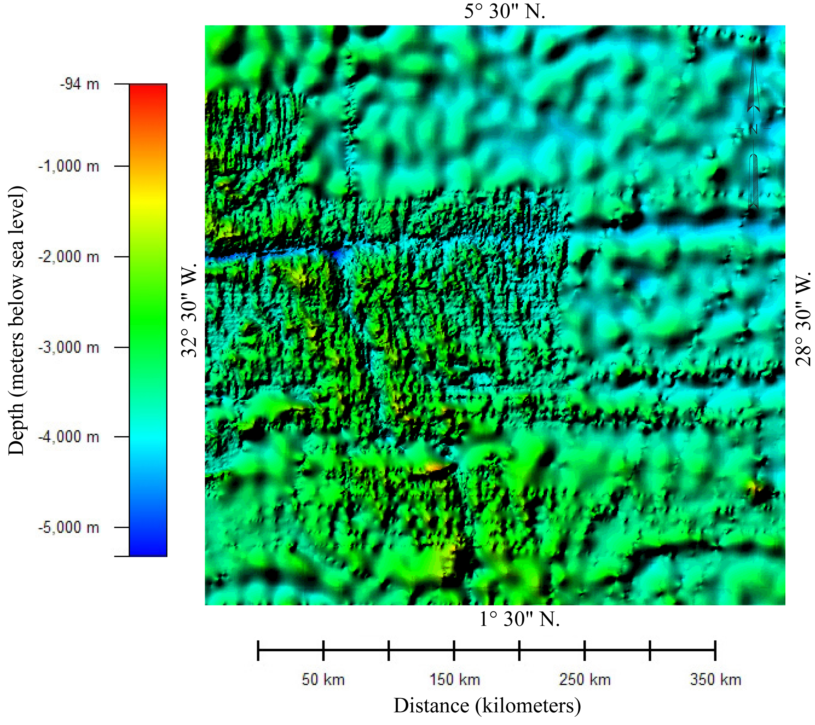
Image: AF447SeaBottom
Description: Color relief map of the bathymetry of the part of Atlantic Ocean in which Air France Flight 447 crashed. The image shows two different data sets with different resolution. The areas showing detailed bathymetry were mapped using multibeam bathmetry sonar. The areas showing very generalized bathmetry were mapped using high-density satellite altimetry. This image was prepared from General Bathymetric Chart of the Oceans (GEBCO) compiled by the British Oceanographic Centre. The 30 arc-second gridded bathymetric data was downloaded from "Gridded bathymetric data sets" at http://www.bodc.ac.uk/data/online_delivery/gebco/. Image was prepared using Global Mapper 8.0 and Adobe Illustrator CS2.
Title: AF447SeaBottom
Credit: Own work
Author: Paradoxides
Usage Terms: Creative Commons Attribution-Share Alike 3.0
License: CC BY-SA 3.0
License Link: https://creativecommons.org/licenses/by-sa/3.0
Attribution Required?: Yes
Image usage
The following page links to this image:
