
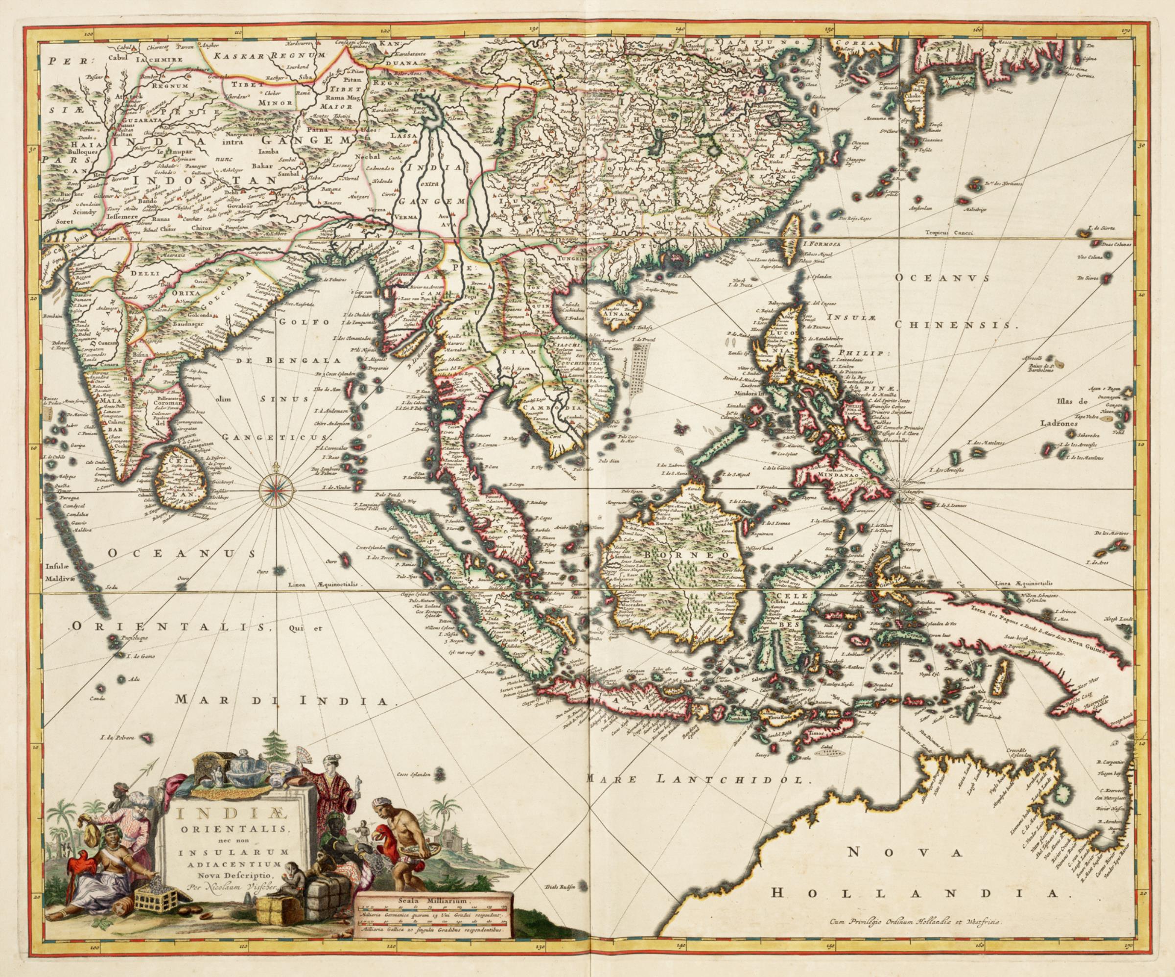
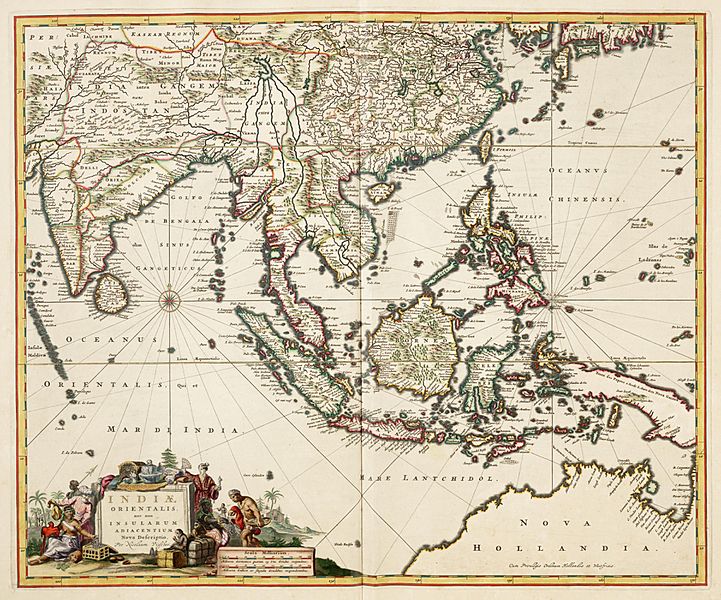
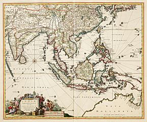
Image: AMH-5638-KB Map of East India
Description: Map of East India, taken from the Atlas van der Hagen, Koninklijke Bibliotheek, The Hague Part 4. This map of South East Asia was published by Nicolaas Visscher II (1649-1702). The map shows the entire trading region of the Dutch East India Company (VOC).
Title: Map of East India
Credit: This is an image from the Atlas of Mutual Heritage and the Koninklijke Bibliotheek, the Dutch National Library. The metadata of this file is public domain under a Creative Commons Public Domain Dedication (CC-ZERO). This permission has been archived as ticket #2014051410008887
Author: Nicolaas Visscher II (publisher)
Permission: This is a faithful photographic reproduction of a two-dimensional, public domain work of art. The work of art itself is in the public domain for the following reason: Public domainPublic domainfalsefalse This work is in the public domain in its country of origin and other countries and areas where the copyright term is the author's life plus 100 years or fewer. You must also include a United States public domain tag to indicate why this work is in the public domain in the United States. This file has been identified as being free of known restrictions under copyright law, including all related and neighboring rights. https://creativecommons.org/publicdomain/mark/1.0/PDMCreative Commons Public Domain Mark 1.0falsefalse The official position taken by the Wikimedia Foundation is that "faithful reproductions of two-dimensional public domain works of art are public domain". This photographic reproduction is therefore also considered to be in the public domain in the United States. In other jurisdictions, re-use of this content may be restricted; see Reuse of PD-Art photographs for details.
Usage Terms: Public domain
License: Public domain
Attribution Required?: No
Image usage
The following page links to this image:
