
Image: AYool topography 15min
Size of this preview: 800 × 561 pixels. Other resolutions: 320 × 224 pixels | 1,617 × 1,133 pixels.
Original image (1,617 × 1,133 pixels, file size: 1.15 MB, MIME type: image/png)
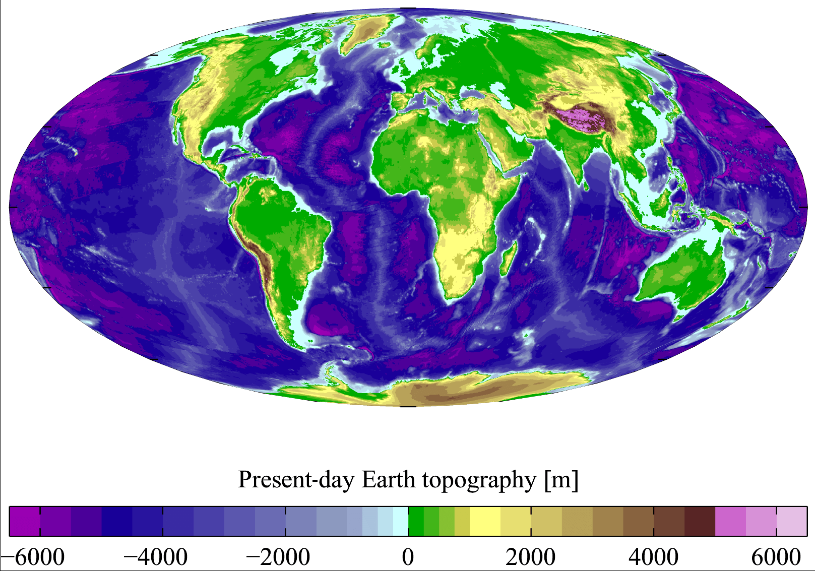
Description: Present-day Earth topography and bathymetry at 15-minute horizontal resolution. Derived from the National Geophysical Data Center's TerrainBase Digital Terrain Model (v1.0). The original dataset is at 5-minute resolution, and this has been averaged down to 15-minute resolution. It is plotted here using a Mollweide projection (using MATLAB and the M_Map package).
Title: AYool topography 15min
Credit: English Wikipedia
Author: Plumbago
Usage Terms: Creative Commons Attribution 2.5
License: CC BY 2.5
License Link: http://creativecommons.org/licenses/by/2.5
Attribution Required?: Yes
Image usage
The following 3 pages link to this image:

All content from Kiddle encyclopedia articles (including the article images and facts) can be freely used under Attribution-ShareAlike license, unless stated otherwise.