
Image: A Plan of Lower Fort Garry (1928) (2196086650)
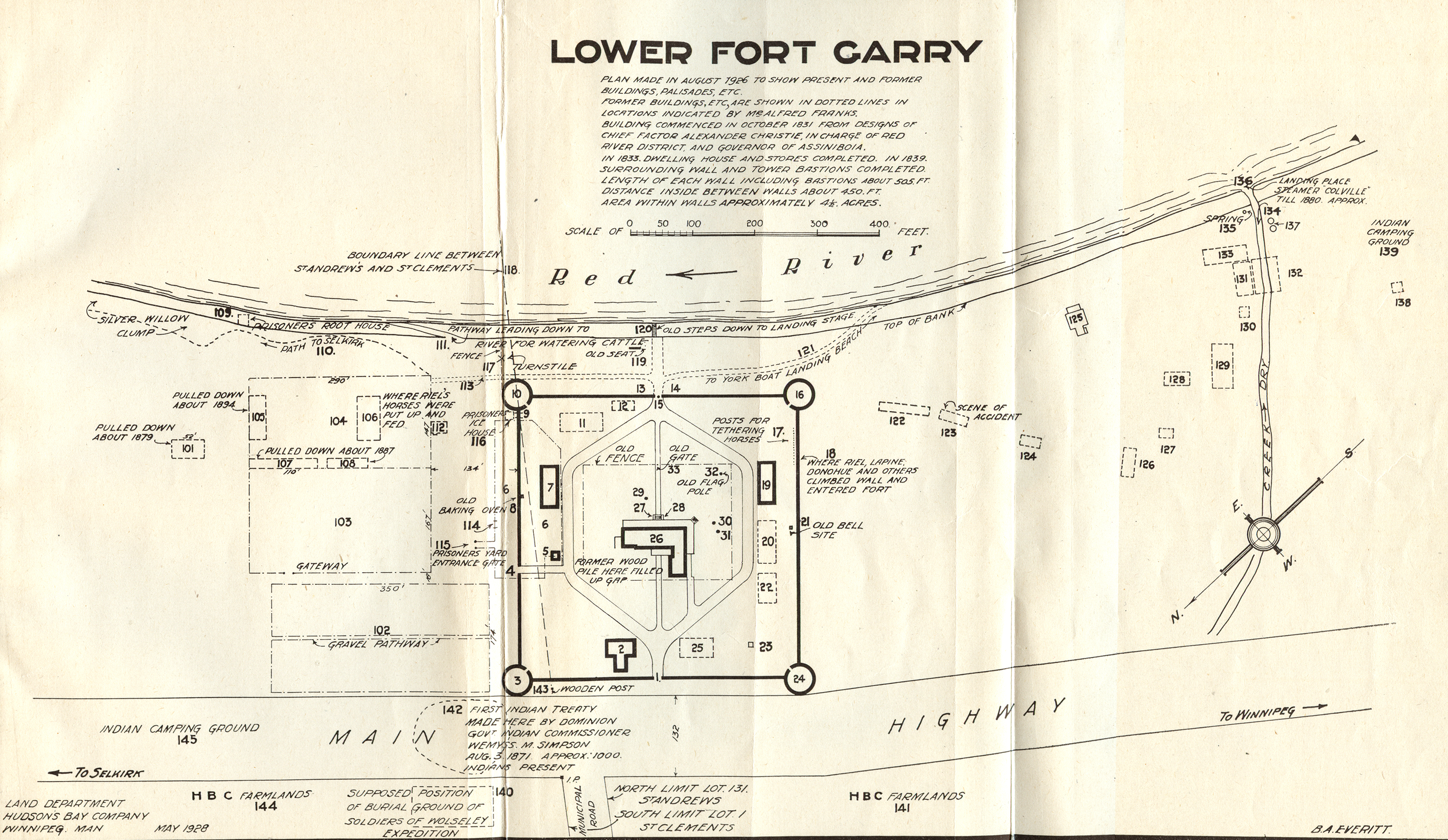
Description: A Plan of Lower Fort Garry (1928) Lower Fort Gary was built in 1831-1839, of local limestone, to replace the establishment at Fort Gary proper as the headquarters of the Hudson’s Bay Company at Red River. However, Fort Garry, soon called Upper Fort Gary and rebuilt after 1835, remained the center of operations for the Hudson’s Bay Company in the region, and the Lower Fort never took over its main functions. The Lower Fort stands today as the only remaining Canadian example of a stone fort built for the purposes of the fur trade. Though it was not of great significance in the fur trade days, it was of some importance during the events of the Riel Resistance as the captions on the map indicate. The first treaty made by the Dominion government with the Indians of western Canada was made outside the gates of the fort in 1871, and the fort served as the base of the North West mounted Police during the First year of the force’s existence in 1873-1874. (Warkentin and Ruggles. Historical Atlas of Manitoba. map 80, p. 196) Lower Fort Gary. May, 1928. Scale 1 inch to 200 feet. Drawn by B.A. Everitt. Printed in Robert Watson. Lower Fort Garry, A history of the Stone Fort. Winnipeg: Hudson’s Bay Company, 1928. Fold out map.
Title: A Plan of Lower Fort Garry (1928) (2196086650)
Credit: A Plan of Lower Fort Garry (1928)
Author: Wyman Laliberte from Edmonton, Canada
Usage Terms: Public domain
License: Public domain
Attribution Required?: No
Image usage
The following page links to this image:

_(2196086650).jpg)