
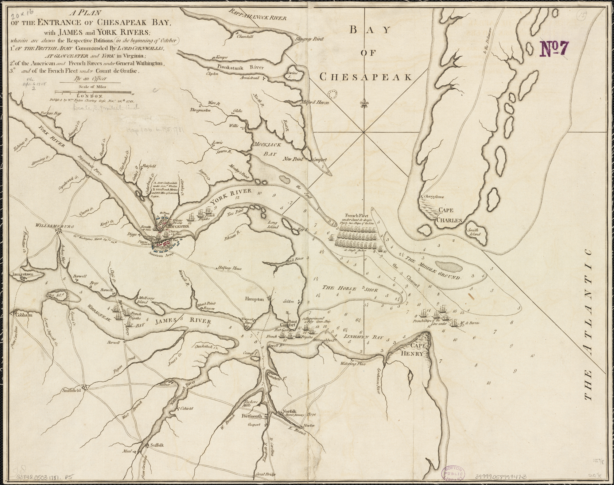
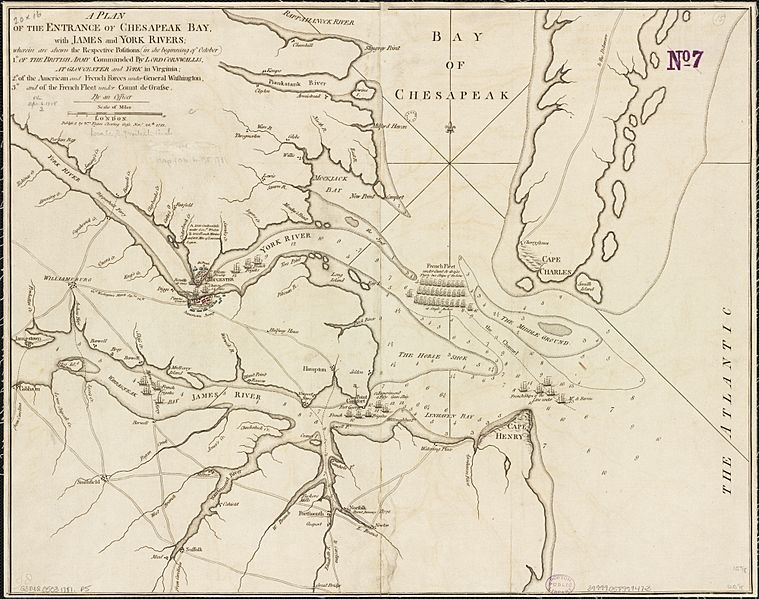
Image: A Plan of the entrance of Chesapeak Bay, with James and York rivers (2675178594)
Size of this preview: 759 × 599 pixels. Other resolutions: 304 × 240 pixels | 2,000 × 1,579 pixels.
Original image (2,000 × 1,579 pixels, file size: 2.38 MB, MIME type: image/jpeg)
Description: Zoom into this map at maps.bpl.org. Publisher: Wm. Faden Date: 1781. Location: Yorktown (Va.) Scale: Scale ca. 1:250,000. Call Number: G3842.C5S3 1781.P5
Title: A Plan of the entrance of Chesapeak Bay, with James and York rivers (2675178594)
Credit: A Plan of the entrance of Chesapeak Bay, with James and York rivers
Author: http://maps.bpl.org
Usage Terms: Creative Commons Attribution 2.0
License: CC BY 2.0
License Link: https://creativecommons.org/licenses/by/2.0
Attribution Required?: Yes
Image usage
The following 2 pages link to this image:

All content from Kiddle encyclopedia articles (including the article images and facts) can be freely used under Attribution-ShareAlike license, unless stated otherwise.
.jpg)