
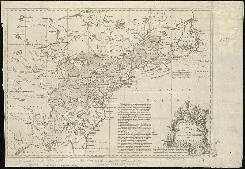
Image: A map of the British and French settlements in North America (4071880581)

Size of this preview: 800 × 551 pixels. Other resolutions: 320 × 220 pixels | 2,000 × 1,377 pixels.
Original image (2,000 × 1,377 pixels, file size: 2.87 MB, MIME type: image/jpeg)
Description: Zoom into this map at maps.bpl.org. Author: Lodge, John Publisher: Date: 1755 Location: North America Dimension: 27×38cm Scale: ca. 1:11,000,000 Call Number: G3300 1750 .L6
Title: A map of the British and French settlements in North America (4071880581)
Credit: A map of the British and French settlements in North America
Author: http://maps.bpl.org
Usage Terms: Creative Commons Attribution 2.0
License: CC BY 2.0
License Link: https://creativecommons.org/licenses/by/2.0
Attribution Required?: Yes
Image usage
The following page links to this image:

All content from Kiddle encyclopedia articles (including the article images and facts) can be freely used under Attribution-ShareAlike license, unless stated otherwise.
.jpg)