
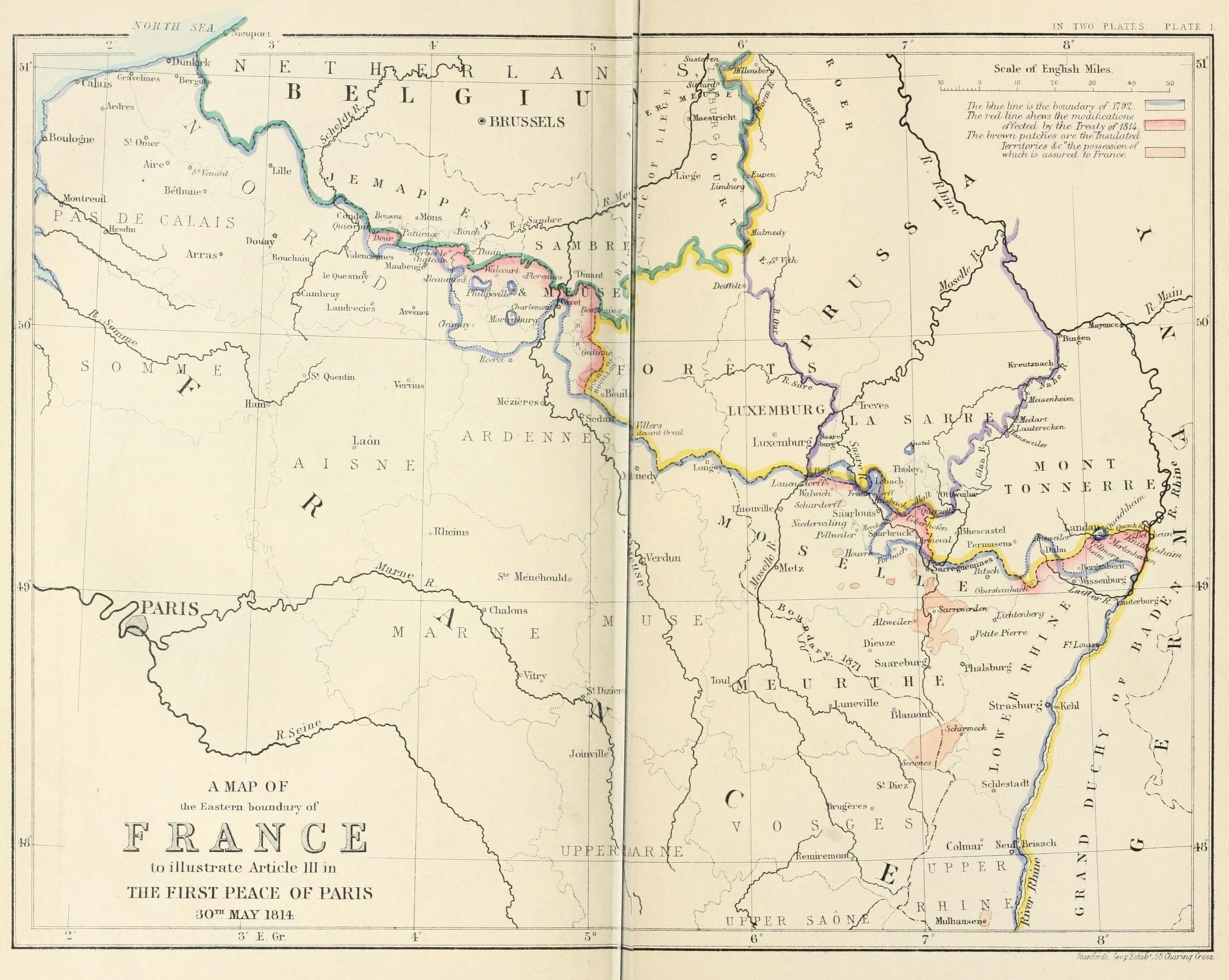
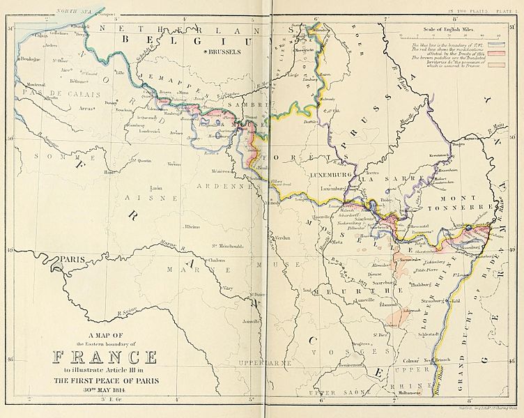
Image: A map of the Eastern boundary of France to illustrate Article III in The First Peace of Paris 30th May 1814
Size of this preview: 752 × 600 pixels. Other resolutions: 301 × 240 pixels | 2,091 × 1,668 pixels.
Original image (2,091 × 1,668 pixels, file size: 1.87 MB, MIME type: image/jpeg)
Description: A map of the Eastern boundary of France to illustrate Article III in The First Peace of Paris 30th May 1814
Title: A map of the Eastern boundary of France to illustrate Article III in The First Peace of Paris 30th May 1814
Credit: Edward Hertslet (1875). The map of Europe by treaty; showing the various political and territorial changes which have taken place since the general peace of 1814, London, Butterworths. p. opposite 28, 351
Author: Edward Hertslet; and Stafford's Geng Estab, 55 Charing Cross
Usage Terms: Public domain
License: Public domain
Attribution Required?: No
Image usage
The following page links to this image:

All content from Kiddle encyclopedia articles (including the article images and facts) can be freely used under Attribution-ShareAlike license, unless stated otherwise.