
Image: Adelaide supplement to the Illustrated Sydney News
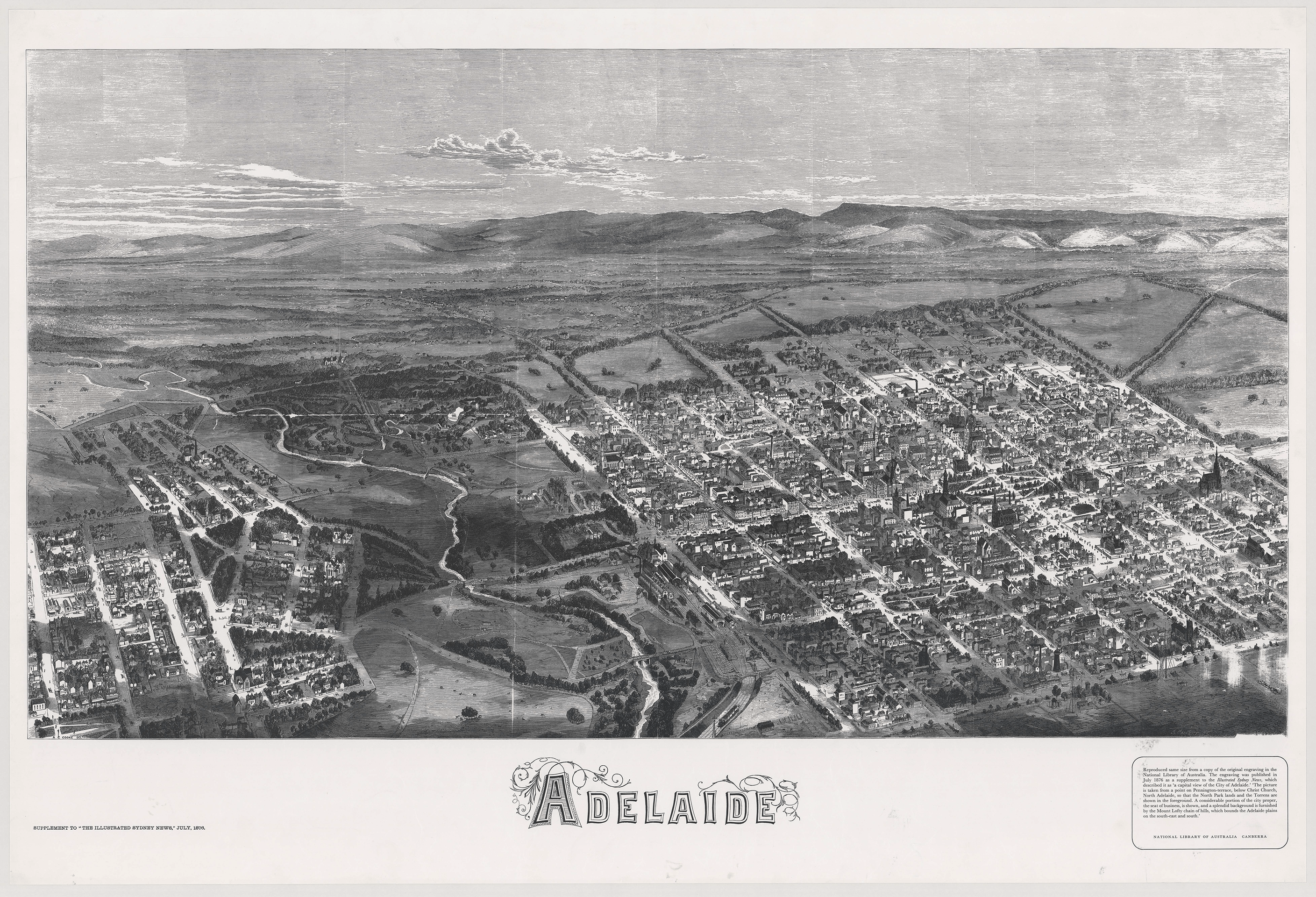
Description: In July 1876, the Illustrated Sydney News published a special supplement that included an early aerial view of the City of Adelaide, the River Torrens and portion of North Adelaide from a point on Pennington Terrace, North Adelaide. Although the map is not drawn to scale, the detail and oblique drawing technique give a fascinating impression of what Adelaide was like in the 1870s. Many of the roads leading in and out of the city were little more than tracks. Businesses were concentrated along King William Street north of Victoria Square. The city still contained patches of open space, especially south of Victoria square. The layout of the Botanic Gardens and attached Botanic Park were evident by 1876. Row cottages housing workers and their families were concentrated in the southern and western portions of the city. The mansions of the wealthy clustered in the east and across the River Torrens in North Adelaide.
Title: Adelaide supplement to the Illustrated Sydney News
Credit: http://adelaidia.sa.gov.au/sites/default/files/images/maps/b1485435.png
Author: Illustrated Sydney News
Usage Terms: Public domain
License: Public domain
Attribution Required?: No
Image usage
The following page links to this image:
