
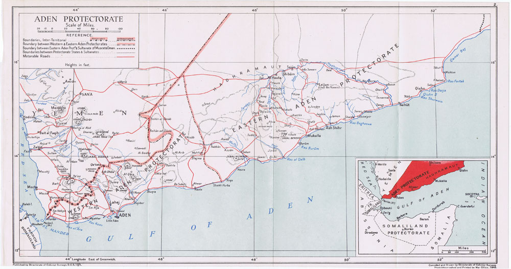
Image: Aden map War Office 1948
Size of this preview: 800 × 421 pixels. Other resolutions: 320 × 168 pixels | 1,000 × 526 pixels.
Original image (1,000 × 526 pixels, file size: 136 KB, MIME type: image/jpeg)
Description: Map of the Aden Protectorate showing the Western and the Eastern Protectorates. Directorate of colonial surveys, 1948
Title: Aden map War Office 1948
Credit: http://www.pennymead.com/results.php?ct=4&sub=9&m=s
Author: Directorate of colonial surveys. Printed by the War Office, UK, 1948
Usage Terms: Public domain
License: Public domain
Attribution Required?: No
Image usage
The following 2 pages link to this image:

All content from Kiddle encyclopedia articles (including the article images and facts) can be freely used under Attribution-ShareAlike license, unless stated otherwise.