
Image: Aeolian Islands map
No higher resolution available.
Aeolian_Islands_map.png (800 × 589 pixels, file size: 144 KB, MIME type: image/png)
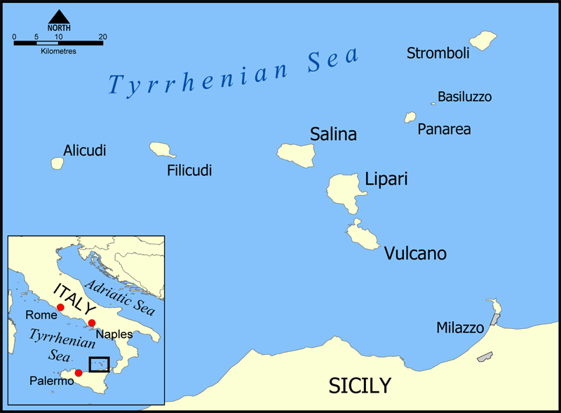
Description: This is a map of the Aeolian Islands off the coast of Sicily, Italy in the Tyrrhenian Sea. The map shows the location of the islands of Salina, Lipari, Vulcano, Alicudi, Filicudi, Panarea, Basiluzzo, and Stromboli. Blank version available at Image:Aeolian Islands blank map.png. Created by NormanEinstein.
Title: Aeolian Islands map
Credit: No machine-readable source provided. Own work assumed (based on copyright claims).
Author: No machine-readable author provided. NormanEinstein assumed (based on copyright claims).
Usage Terms: Creative Commons Attribution-Share Alike 3.0
License: CC-BY-SA-3.0
License Link: http://creativecommons.org/licenses/by-sa/3.0/
Attribution Required?: Yes
Image usage
The following 2 pages link to this image:

All content from Kiddle encyclopedia articles (including the article images and facts) can be freely used under Attribution-ShareAlike license, unless stated otherwise.