
Image: Aerial image of Christchurch suburbs - Flickr - NZ Defence Force (1)

Size of this preview: 800 × 532 pixels. Other resolutions: 320 × 213 pixels | 1,800 × 1,198 pixels.
Original image (1,800 × 1,198 pixels, file size: 564 KB, MIME type: image/jpeg)
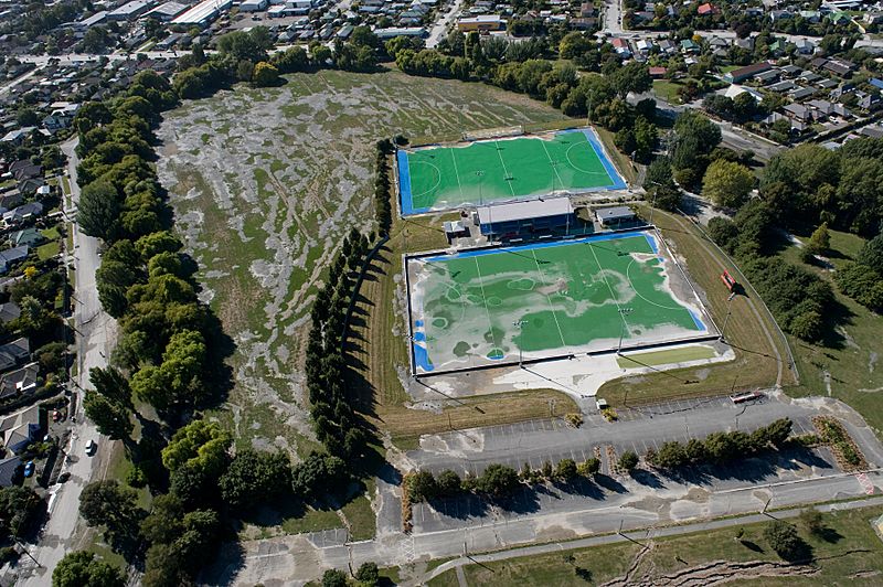
Description: Aerial view of Porritt Park, Christchurch, 5 days after the February 2011 earthquake. Much of the park is covered in mud produced by liquefaction. Flickr caption: "Aerial image of Christchurch suburbs for the Earthquake Commission 20110227_WN_S1015650_0012."
Title: Aerial image of Christchurch suburbs - Flickr - NZ Defence Force (1)
Credit: Aerial image of Christchurch suburbs
Author: New Zealand Defence Force from Wellington, New Zealand
Usage Terms: Creative Commons Attribution 2.0
License: CC BY 2.0
License Link: http://creativecommons.org/licenses/by/2.0
Attribution Required?: Yes
Image usage
The following page links to this image:

All content from Kiddle encyclopedia articles (including the article images and facts) can be freely used under Attribution-ShareAlike license, unless stated otherwise.
.jpg)