
Image: Aerial travel for Business or Pleasure - Thos Cook & Son - 1919 - pp 16+ (map)
Size of this preview: 498 × 599 pixels. Other resolutions: 199 × 240 pixels | 660 × 794 pixels.
Original image (660 × 794 pixels, file size: 175 KB, MIME type: image/jpeg)
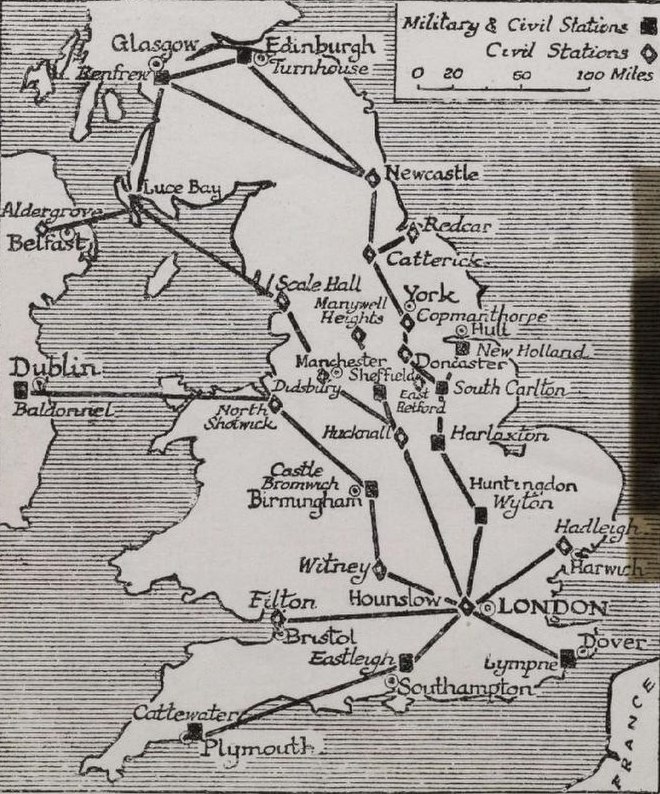
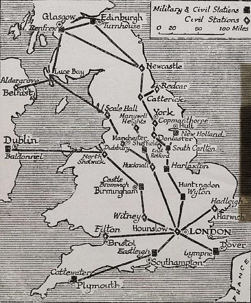
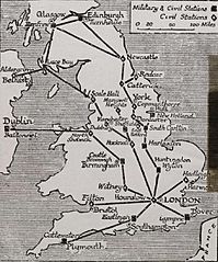
Description: Aerial travel for Business or Pleasure - Thos Cook & Son - 1919 - page 16, map. Original caption: "Map of Air Routes and Landing Places in Great Britain, as temporarily arranged by the Air Ministry for civilian flying."
Title: Aerial travel for Business or Pleasure - Thos Cook & Son - 1919 - pp 16+ (map)
Credit: File:Aerial travel for Business or Pleasure - Thos Cook & Son - 1919.pdf
Author: AnonymousUnknown author
Usage Terms: Public domain
License: Public domain
Attribution Required?: No
Image usage
The following 7 pages link to this image:

All content from Kiddle encyclopedia articles (including the article images and facts) can be freely used under Attribution-ShareAlike license, unless stated otherwise.
.jpg)