
Image: Afghanistan physical en
Size of this preview: 768 × 600 pixels. Other resolutions: 307 × 240 pixels | 2,079 × 1,624 pixels.
Original image (2,079 × 1,624 pixels, file size: 4.46 MB, MIME type: image/png)
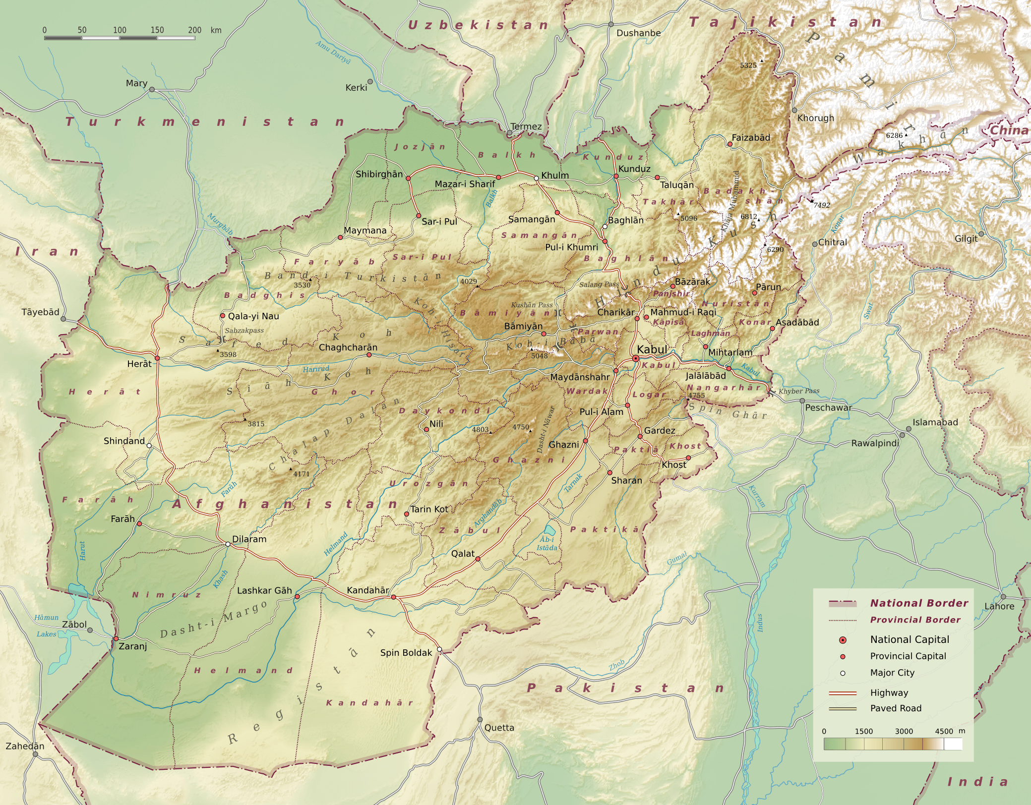
Description: Physical map of Afghanistan, administrative division into 34 provinces following the administrative reform from 2005. (Note: Safed-Koh mountain range mark seems to be wrong placed. Probably it meens the Paropamisus mountains.)map1map2geographic.org
Title: Afghanistan physical en
Credit: Selfmade, based on topographic data: SRTM30 V2.1
Author: User:Sommerkom
Usage Terms: Creative Commons Attribution-Share Alike 3.0
License: CC BY-SA 3.0
License Link: http://creativecommons.org/licenses/by-sa/3.0
Attribution Required?: Yes
Image usage
The following 3 pages link to this image:

All content from Kiddle encyclopedia articles (including the article images and facts) can be freely used under Attribution-ShareAlike license, unless stated otherwise.