
Image: Al-Idrisi's world map
Size of this preview: 550 × 599 pixels. Other resolutions: 220 × 240 pixels | 1,424 × 1,552 pixels.
Original image (1,424 × 1,552 pixels, file size: 917 KB, MIME type: image/jpeg)
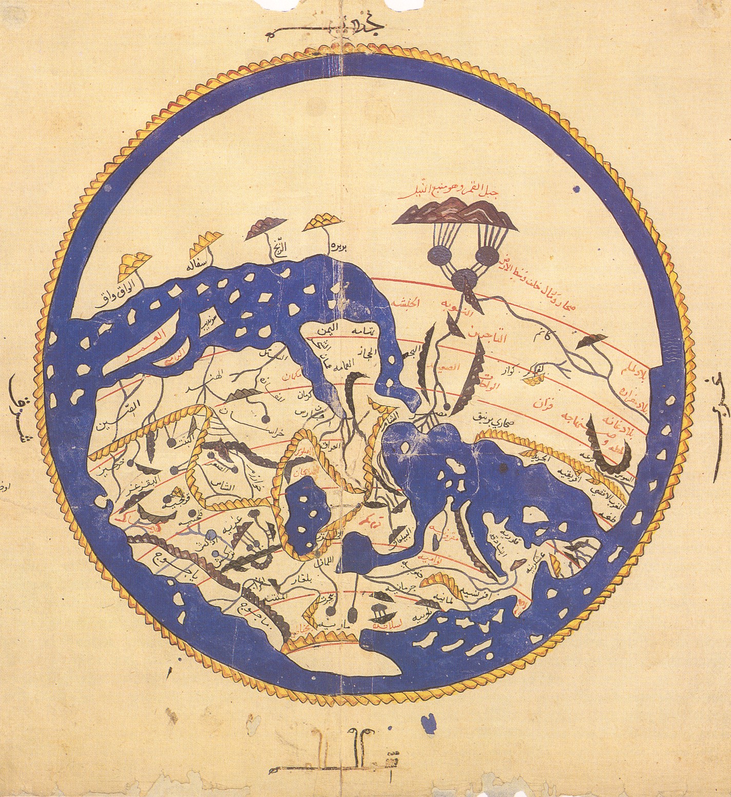
Title: Al-Idrisi's world map from 'Alî ibn Hasan al-Hûfî al-Qâsimî's 1456 copy. According to the French National Library, "Ten copies of the Kitab Rujar or Tabula Rogeriana exist worldwide today. Of these ten, six contain at the start of the work a circular map of the world which is not mentioned in the text of al-Idris". The original text dates to 1154. Note that south is at the top of the map.
Usage Terms: Public domain
License: Public domain
Attribution Required?: No
Image usage
The following 4 pages link to this image:

All content from Kiddle encyclopedia articles (including the article images and facts) can be freely used under Attribution-ShareAlike license, unless stated otherwise.