
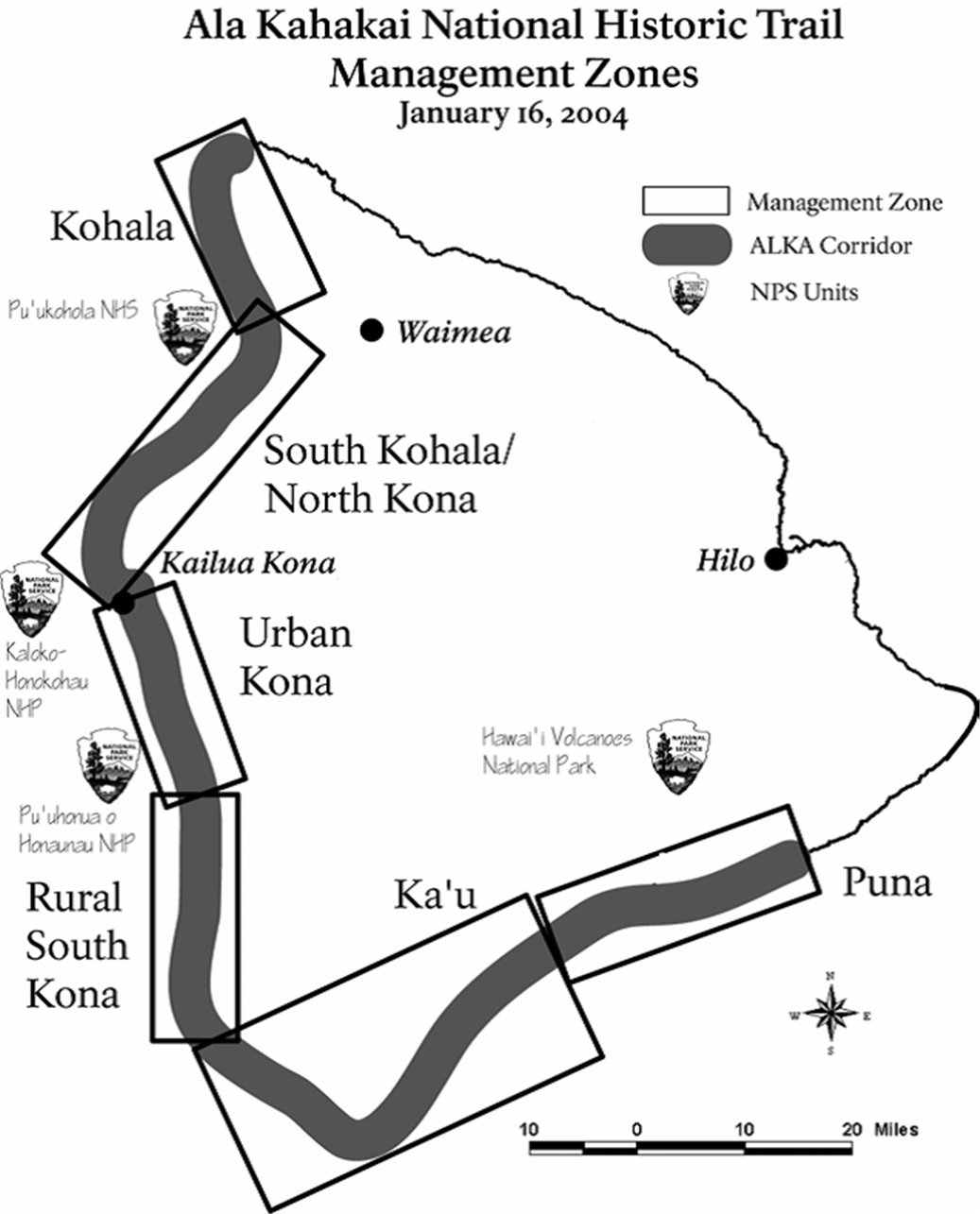
Image: Ala Kahakai Districts
Size of this preview: 484 × 600 pixels. Other resolutions: 194 × 240 pixels | 1,037 × 1,285 pixels.
Original image (1,037 × 1,285 pixels, file size: 167 KB, MIME type: image/jpeg)
Description: District map of the Ala Kahakai National Historic Trail on the Big Island of Hawaii
Title: Ala Kahakai Districts
Credit: Comprehensive Managament Plan prepared by National Park Service
Author: U.S. National Park Service
Usage Terms: Public domain
License: Public domain
Attribution Required?: No
Image usage
The following page links to this image:

All content from Kiddle encyclopedia articles (including the article images and facts) can be freely used under Attribution-ShareAlike license, unless stated otherwise.