
Image: Alberta Topo Labeled 90 dpi
Size of this preview: 381 × 599 pixels. Other resolutions: 153 × 240 pixels | 2,100 × 3,300 pixels.
Original image (2,100 × 3,300 pixels, file size: 12.08 MB, MIME type: image/png)
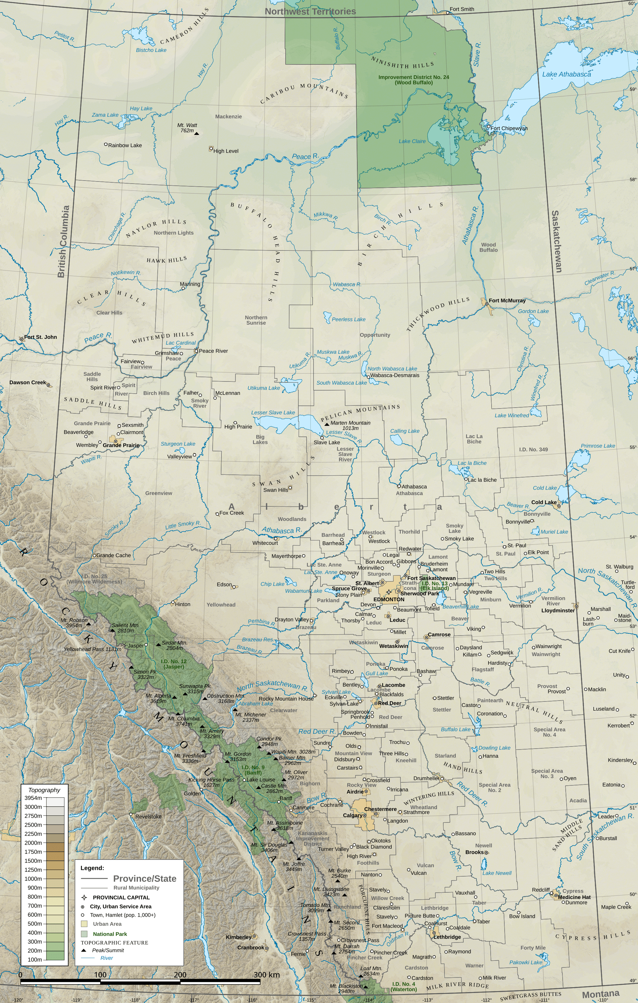
Description: A topographic map of the province of Alberta, Canada, with cities, towns, rural municipalities, and natural features.
Title: Alberta Topo Labeled 90 dpi
Credit: Own work, generated in QGIS Elevation: GMTED2010 from the USGS Municipalities: 2016 Census Subdivisions and Census Consolidated Subdivisions from the federal government of Canada Water boundary files come from the same source, except for American water bodies American state lines are from TIGER
Author: Awmcphee
Usage Terms: Creative Commons Attribution-Share Alike 4.0
License: CC BY-SA 4.0
License Link: http://creativecommons.org/licenses/by-sa/4.0
Attribution Required?: Yes
Image usage
The following 2 pages link to this image:

All content from Kiddle encyclopedia articles (including the article images and facts) can be freely used under Attribution-ShareAlike license, unless stated otherwise.