
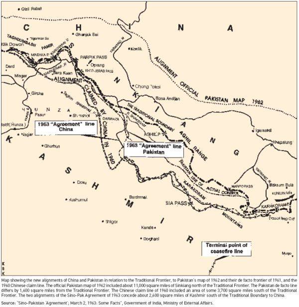
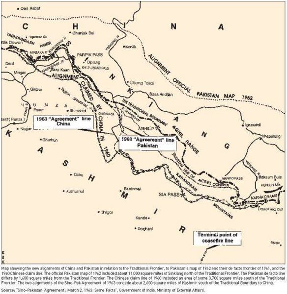
Image: Alignment Official Pakistan map 1962
Size of this preview: 584 × 600 pixels. Other resolutions: 234 × 240 pixels | 600 × 616 pixels.
Original image (600 × 616 pixels, file size: 59 KB, MIME type: image/jpeg)
Description: Map depicting the official alignment of the northern border of Kashmir in 1962 according to the Government of Pakistan
Title: Alignment Official Pakistan map 1962
Credit: Sino Pakistan "Agreement", March 2, 1963 "Some facts" published by the Government of India, Ministry of External Affairs
Author: The Government of India, Ministry of External Affairs
Usage Terms: Public domain
License: Public domain
Attribution Required?: No
Image usage
The following page links to this image:

All content from Kiddle encyclopedia articles (including the article images and facts) can be freely used under Attribution-ShareAlike license, unless stated otherwise.