
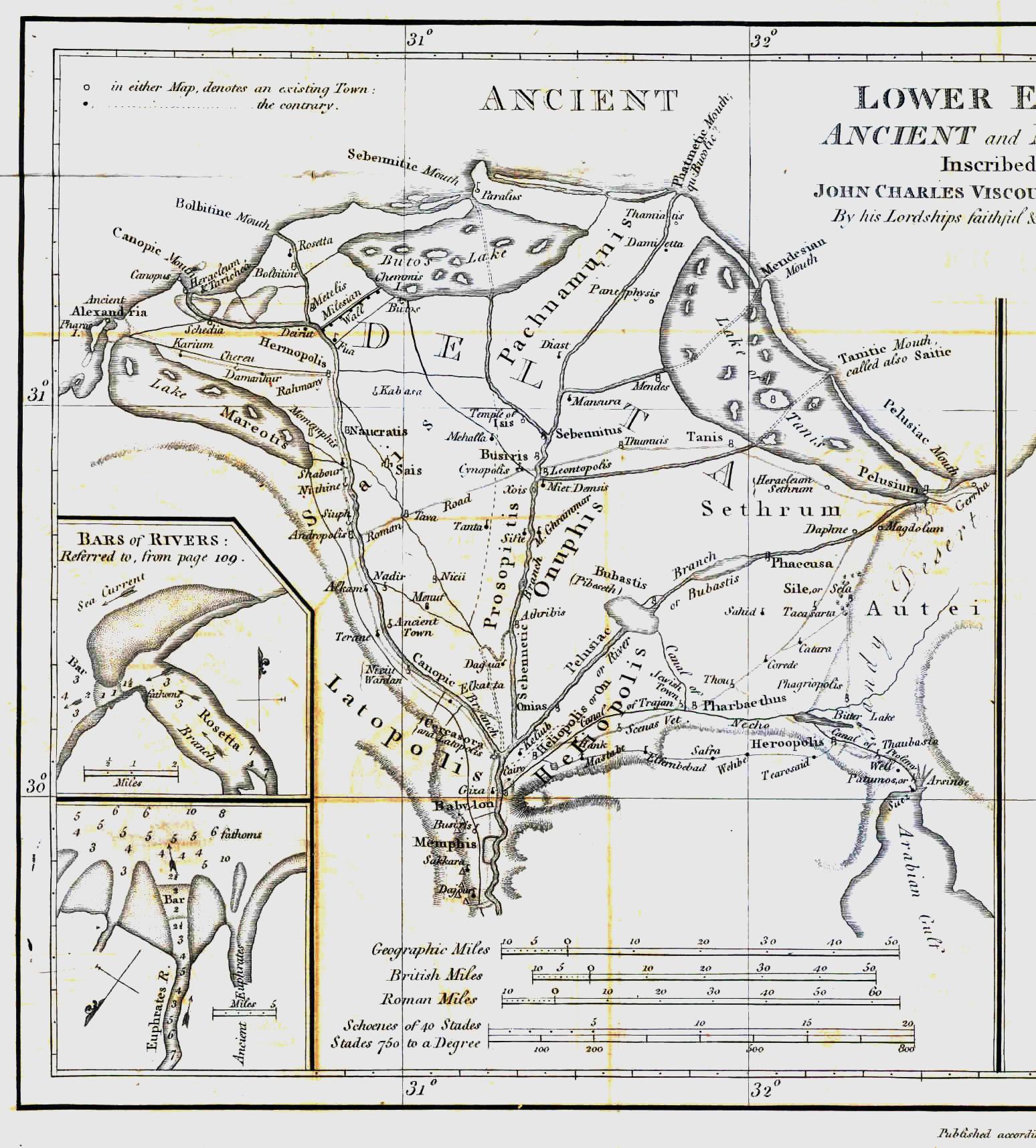
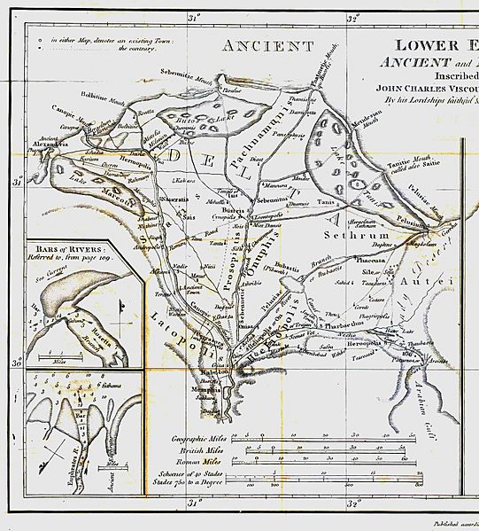
Image: AncientEgyptJamesRennell01
Size of this preview: 541 × 599 pixels. Other resolutions: 217 × 240 pixels | 1,548 × 1,715 pixels.
Original image (1,548 × 1,715 pixels, file size: 384 KB, MIME type: image/jpeg)
Description: Map of ancient Egypt created by James Rennell as an insert for his book "The geographical system of Herodotus examined and explained" (published 1800 and 1830). This map shows Rennell's understanding of the geography of Egypt's Nile delta during the Greek Classical period (510 BC - 323 BC) based on the writings of Herodotus (484 BC - 425 BC).
Title: AncientEgyptJamesRennell01
Credit: Book "The geographical system of Herodotus examined and explained", by James Rennell (published 1800 and 1830).
Author: Carl Drews scanned the map and enhanced the color contrast.
Usage Terms: Public domain
License: Public domain
Attribution Required?: No
Image usage
The following 2 pages link to this image:

All content from Kiddle encyclopedia articles (including the article images and facts) can be freely used under Attribution-ShareAlike license, unless stated otherwise.