
Image: Ancient Egypt map-en

Size of this PNG preview of this SVG file: 293 × 598 pixels. Other resolution: 117 × 240 pixels.
Original image (SVG file, nominally 1,577 × 3,219 pixels, file size: 413 KB)
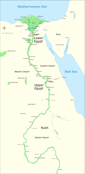
Description: Map of Ancient Egypt, showing the Nile up to the fifth cataract, and major cities and sites of the Dynastic period (c. 3150 BC to 30 BC). Cairo and Jerusalem are shown as reference cities.
Title: Ancient Egypt map-en
Credit: Own work. See #References for references used creating the map. Image renamed from File:Ancient Egypt map.svg (see #Original upload log).
Author: Jeff Dahl
Usage Terms: GNU Free Documentation License
License: GFDL
License Link: http://www.gnu.org/copyleft/fdl.html
Attribution Required?: Yes
Image usage
The following 5 pages link to this image:

All content from Kiddle encyclopedia articles (including the article images and facts) can be freely used under Attribution-ShareAlike license, unless stated otherwise.