
Image: Ancient Provinces of Japan Ryoseikoku Map
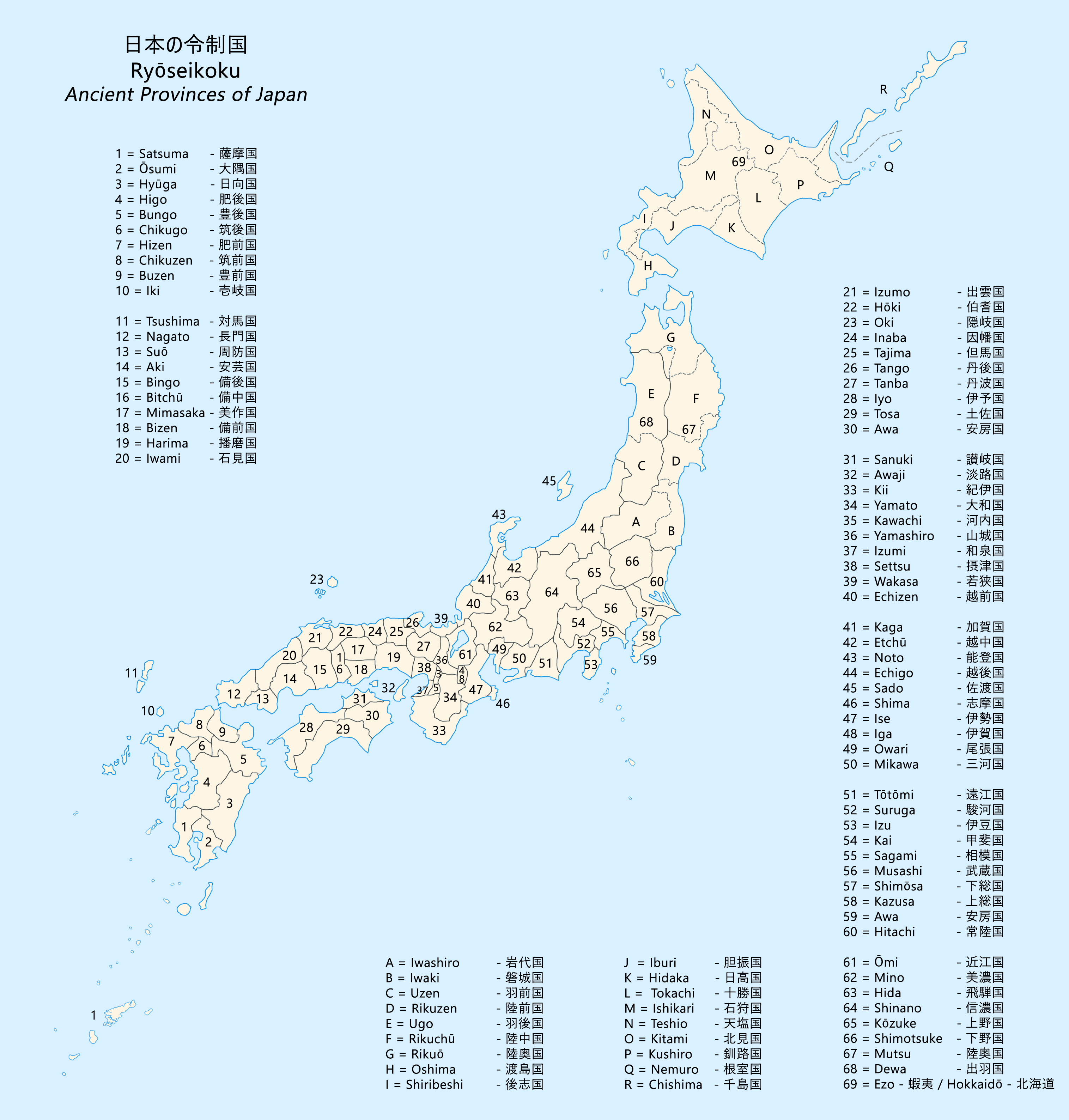
Description: Ancient provinces of Japan map (令制国, Ryōseikoku). Ryōseikoku were first-level administrative divisions of Japan from the 600s to 1868. The solid borders of the provinces are from the Kamakura period (1185) until the Meiji Restoration (1868). In 712 the province of Mutsu, containing all of Tōhoku, was divided into Dewa Province and Mutsu Province. The dashed borders are the following: 11 provinces of Hokkaido were established in 1869 and dissolved into Hokkaido in 1882. In 1869, Mutsu Province was divided into 5 provinces and Dewa Province was divided into 2 provinces until 1876. In 1869 Chishima Province was created with 5 districts, by 1875 it included all Kuril islands. The Satsunan Islands (薩南諸島, Satsunan-shotō) to the southwest were annexed by the Satsuma Domain in 1609.
Title: Ancient Provinces of Japan Ryoseikoku Map
Credit: Own work
Author: Artanisen
Usage Terms: Creative Commons Attribution-Share Alike 4.0
License: CC BY-SA 4.0
License Link: https://creativecommons.org/licenses/by-sa/4.0
Attribution Required?: Yes
Image usage
The following 2 pages link to this image:
