
Image: Antarctica (5), Adelaide Island, Webb Island

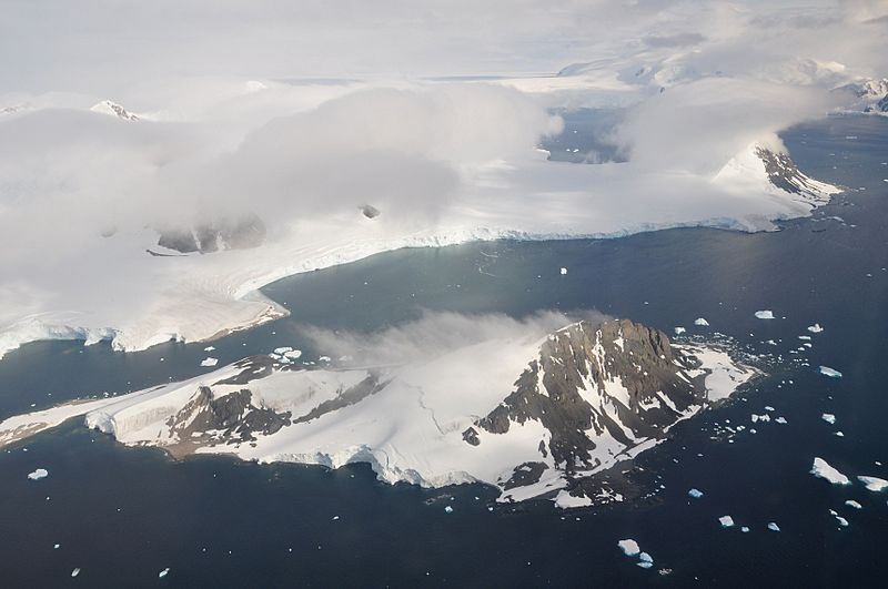
Description: This picture is from the SW Antarctic Peninsula region. It's an aerial view from a position over Laubeuf Fjord, looking to the NW. In the foreground is Webb Island with its summit of 398 m. Behind it is a part of the Wright Peninsula on Adelaide Island's east coast. This coast's high ice cliffs are from the Wormald Ice Piedmont that covers most of the Wright Peninsula's east coast. The cloud-covered mountains on the left are the Stokes Peaks. The lone cloud-covered mountain at the right -at the NE extremity of the Wright Peninsula-is Sighing Peak; behind it is Stonehouse Bay. The maritime channel right of Sighing Peak is called Cole Channel (and is actually a part of Laubeuf Fjord). In the upper right hand corner of the picture is the Mount Bouvier Massif. At the foot of these mountains the Shambles Glacier can just be seen through a hole in the clouds. It is Adelaide Island's largest glacier and is heavily crevassed.
Title: Antarctica (5), Adelaide Island, Webb Island
Credit: Own work
Author: Vincent van Zeijst
Usage Terms: Creative Commons Attribution-Share Alike 3.0
License: CC BY-SA 3.0
License Link: http://creativecommons.org/licenses/by-sa/3.0
Attribution Required?: Yes
Image usage
The following 2 pages link to this image:

,_Adelaide_Island,_Webb_Island.JPG)